

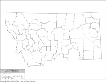
Outline Map of Montana with County Borders
| Dimensions: | 7.5 x 10.0 in (19.1 x 25.4cm) |
|---|---|
| Publisher or Printer: | World Trade Press |
| Published in: | Traverse City, MI |
| Year Published: | 2020 |
An outline map of Montana showing county boundaries in black and white.
Features on This Map:
- Legend
- Coastline (if app.)
- County Borders
- State Borders
- Projection: Lambert Conformal Conic
View, Print, Download
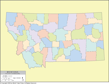
Outline Map of Montana with County Borders in Color
| Dimensions: | 7.5 x 10.0 in (19.1 x 25.4cm) |
|---|---|
| Publisher or Printer: | World Trade Press |
| Published in: | Traverse City, MI |
| Year Published: | 2020 |
An outline map of Montana showing only county boundaries in color contrast.
Features on This Map:
- Legend
- Coastline (if app.)
- County Borders
- County Color Fill
- State Borders
- Sea Color (if app.)
- Background Color
- Projection: Lambert Conformal Conic
View, Print, Download
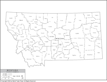
Political Outline Map of Montana with County Borders (Pol3)
| Dimensions: | 7.5 x 10.0 in (19.1 x 25.4cm) |
|---|---|
| Publisher or Printer: | World Trade Press |
| Published in: | Traverse City, MI |
| Year Published: | 2020 |
An outline map of Montana showing county boundaries with county names in black and white.
Features on This Map:
- Legend
- State Name
- County Borders
- County Names
- Coastline (if app.)
- State Border
- Projection: Lambert Conformal Conic
View, Print, Download
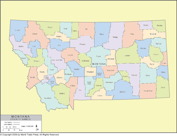
Political Outline Map of Montana with County Data (Pol4)
| Dimensions: | 7.5 x 10.0 in (19.1 x 25.4cm) |
|---|---|
| Publisher or Printer: | World Trade Press |
| Published in: | Traverse City, MI |
| Year Published: | 2020 |
A planimetric map of Montana showing county boundaries in color contrast with county names.
Features on This Map:
- Legend
- State Name
- State Border
- Coastline (if app.)
- International Border (if app.)
- County Borders
- County Names
- County Color Fill
- Projection: Lambert Conformal Conic
View, Print, Download
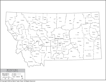
Political Outline Map of Montana with County Data (Pol5)
| Dimensions: | 7.5 x 10.0 in (19.1 x 25.4cm) |
|---|---|
| Publisher or Printer: | World Trade Press |
| Published in: | Traverse City, MI |
| Year Published: | 2020 |
An outline map of Montana showing county boundaries with county names and county seats in black and white.
Features on This Map:
- Legend
- State Name
- Coastline (if app.)
- County Borders
- County Names
- County Seat Located by Icon
- County Seat Names
- Projection: Lambert Conformal Conic
View, Print, Download
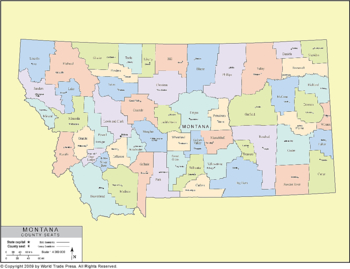
Political Outline Map of Montana with County Data (Pol6)
| Dimensions: | 7.5 x 10.0 in (19.1 x 25.4cm) |
|---|---|
| Publisher or Printer: | World Trade Press |
| Published in: | Traverse City, MI |
| Year Published: | 2020 |
A planimetric map of Montana showing county boundaries in color contrast, with county names and county seats.
Features on This Map:
- Legend
- State Name
- Coastline (if app.)
- County Borders
- County Names
- County Color Fill
- County Seat Located by Icon
- County Seat Names
- Projection: Lambert Conformal Conic
View, Print, Download
Political Outline Map of Montana with County Data (Pol7)
| Dimensions: | 7.5 x 10.0 in (19.1 x 25.4cm) |
|---|---|
| Publisher or Printer: | World Trade Press |
| Published in: | Traverse City, MI |
| Year Published: | 2020 |
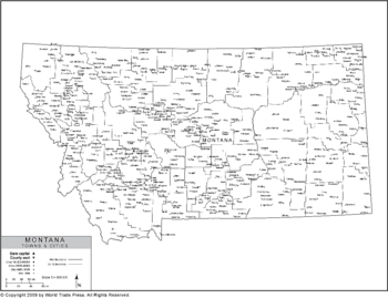
An outline map of Montana showing county boundaries with county names, state capital, county seats and major and secondary cities in black and white.
Features on This Map:
- Legend
- Coastline (if app.)
- County Borders
- County Names
- County Seat Located by Icon
- County Seat Names
- Major Cities Located by Icon
- Major City Names
- Secondary Cities/Towns Located by Icon
- Names of Secondary Cities/Towns
- Projection: Lambert Conformal Conic
View, Print, Download
Political Outline Map of Montana with County Data (Pol8)
| Dimensions: | 7.5 x 10.0 in (19.1 x 25.4cm) |
|---|---|
| Publisher or Printer: | World Trade Press |
| Published in: | Traverse City, MI |
| Year Published: | 2020 |
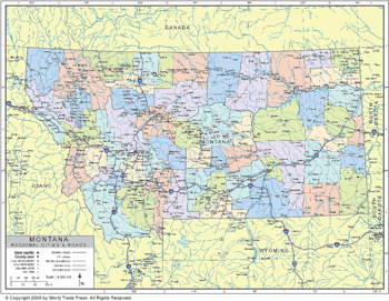
A planimetric map of Montana showing county boundaries in color contrast, county names, capitals, major and secondary cities or towns, major highways, major river systems and major lakes.
Features on This Map:
- Legend
- Coastline (if app.)
- County Borders
- County Names
- Capital Located by Icon
- Capital Name
- Major Cities Located by Icon
- Major City Names
- Secondary Cities/Towns Located by Icon
- Names of Secondary Cities/Towns
- Lake and Sea Color
- Lake and Sea Names
- Major Rivers Level 1
- Major Rivers Level 2
- Major Rivers Level 3
- Major River Names
- Major Lakes
- Interstate Highways
- Interstate Highway Labels
- U.S. Highways
- U.S. Highway Labels
- State Highways
- State Highway Labels
- Longitude/Latitude Graticules
- Projection: Lambert Conformal Conic
View, Print, Download
Political Outline Map of Montana with County Data (Pol9)
| Dimensions: | 7.5 x 10.0 in (19.1 x 25.4cm) |
|---|---|
| Publisher or Printer: | World Trade Press |
| Published in: | Traverse City, MI |
| Year Published: | 2020 |
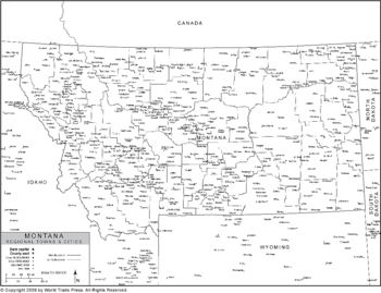
A planimetric map of Montana showing county boundaries with county names, capitals, major and secondary cities or towns shown in black and white. Also shows cities and towns outside of state.
Features on This Map:
- Legend
- Coastline (if app.)
- State Border
- County Borders
- County Names
- State Capital Located by Icon
- State Capital Name
- Major Cities Located by Icon
- Major City Names
- Secondary Cities/Towns Located by Icon
- Names of Secondary Cities/Towns
- State Borders Outside of State
- State Names Outside of State
- Province Names Outside of State (if app.)
- County Capital Outside of State Located by Icon
- County Capitals Outside of State
- Major Cities Outside of State Located by Icon
- Major City Names Outside of State
- Secondary Cities/Towns Outside of State Located by Icon
- Names of Secondary Cities/Towns Outside of State
- Projection: Lambert Conformal Conic
View, Print, Download
Political Outline Map of Montana with County Data (Pol10)
| Dimensions: | 7.5 x 10.0 in (19.1 x 25.4cm) |
|---|---|
| Publisher or Printer: | World Trade Press |
| Published in: | Traverse City, MI |
| Year Published: | 2020 |
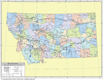
A planimetric map of Montana showing county boundaries in color contrast, county names, state capital, county seats, major and secondary cities and towns, major highways, state highways, major river systems and major lakes.
Features on This Map:
- Legend
- Coastline (if app.)
- County Borders
- County Names
- Capital Located by Icon
- Capital Name
- Major Cities Located by Icon
- Major City Names
- Secondary Cities/Towns Located by Icon
- Names of Secondary Cities/Towns
- Lake and Sea Color
- Lake and Sea Names
- Major Rivers Level 1
- Major Rivers Level 2
- Major Rivers Level 3
- Major River Names
- Major Lakes
- Interstate Highways
- Interstate Highway Labels
- U.S. Highways
- U.S. Highway Labels
- State Highways
- State Highway Labels
- State Names Outside of State
- Province Names Outside of State (if app.)
- County Capital Outside of State Located by Icon
- County Capitals Outside of State
- Major Cities Outside of State Located by Icon
- Major City Names Outside of State
- Secondary Cities/Towns Outside of State Located by Icon
- Names of Secondary Cities/Towns Outside of State
- Longitude/Latitude Graticules
- Projection: Lambert Conformal Conic
View, Print, Download
Copyright © 1993-2025 World Trade Press. All rights reserved.
