

Ecoregion "Provinces" are regional climatic and vegetation types within Divisions. Provinces are differentiated based on dominant potential natural vegetation types and land covers. Mountainous areas that exhibit different ecological zones based on elevation are identified at this level. Provinces range in size from three thousand square miles (7,800 sq km) to tens of thousands of square miles (multiples of 26,000 sq km). There are 52 Ecoregion Provinces.
Ecoregion Provinces are described by land form, climate, vegetation, soils, and fauna.
See the "Ecoregions Introduction" for information about Domains, Divisions, Provinces and Sections.
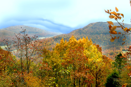
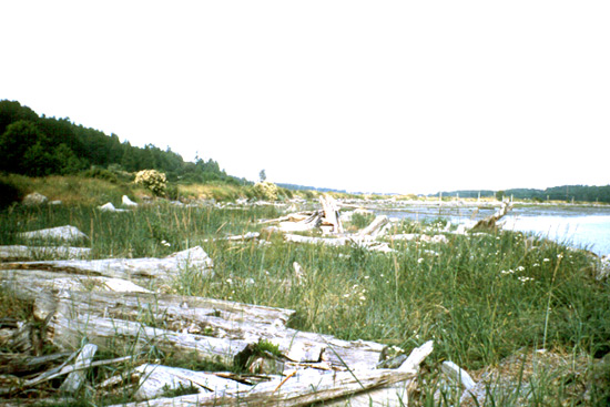
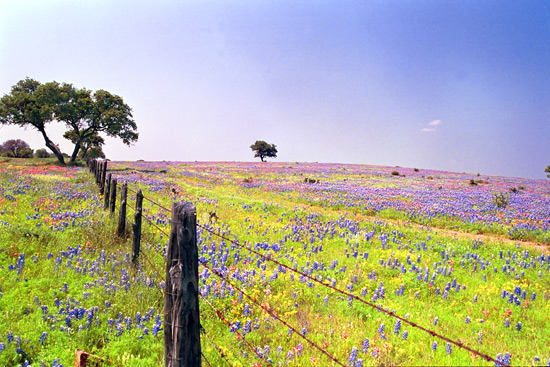
Province 212, part of the HUMID TEMPERATE DOMAIN
Laurentian Mixed Forest
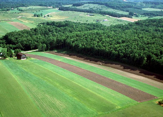
North-central lake-swamp-morainic plains, New England lowlands, 147,300 mi2 (381,500 km2)
Stand of Beech and Hemlock Land-Surface Form
Most of this province has low relief, but rolling hills occur in many places. Lakes, poorly drained depressions, morainic hills, drumlins, eskers, outwash plains, and other glacial features are typical of the area, which was entirely covered by glaciers during parts of the Pleistocene. Elevations range from sea level to 2,400 ft (730 m).
This stand of beech and hemlock illustrates mixed deciduous- coniferous forest in the Laurentian Mixed Forest Province, Allegheny National Forest, Pennsylvania.
Climate
Winters are moderately long and somewhat severe, but more than 120 days have temperatures above 50F (10C). Average annual temperatures range from 35 to 50F (2 to 10C). A short growing season imposes severe restrictions on agriculture; the frost-free season lasts from 100 to 140 days. Snow usually stays on the ground all winter. During winter, the province lies north of the main cyclonic belt; but during summer it lies within this belt, and the weather is changeable. Average annual precipitation is moderate, ranging from 24 to 45 in (610 to 1,150 mm); maximum precipitation comes in summer.
Vegetation
This province lies between the boreal forest and the broadleaf deciduous forest zones and is therefore transitional. Part of it consists of mixed stands of a few coniferous species (mainly pine) and a few deciduous species (mainly yellow birch, sugar maple, and American beech); the rest is a macromosaic of pure deciduous forest in favorable habitats with good soils and pure coniferous forest in less favorable habitats with poor soils. Mixed stands have several species of conifer, mainly northern white pine in the Great Lakes region, with an admixture of eastern hemlock. Eastern redcedar is found in the southeast. Pine trees are often the pioneer woody species that flourish in burned-over areas or on abandoned arable land. Because they grow more rapidly than deciduous species where soils are poor, they quickly form a forest canopy; but where deciduous undergrowth is dense, they have trouble regenerating, and remain successful only where fire recurs. Fires started by lightning are common in this province, particularly where soils are sandy and there is a layer of dry litter in summer.
Soils
The greatly varying soils include peat, muck, marl, clay, silt, sand, gravel, and boulders, in various combinations. Spodosols are dominant in New England and along the Great Lakes coast; Inceptisols and Alfisols dominate farther inland. The Alfisols are medium to high in bases and have gray to brown surface horizons and subsurface horizons of clay accumulation.
Fauna
In winter, the shorttail weasel (ermine) and snowshoe hare turn white, as they do in polar provinces. The black bear, striped skunk, marmot, chipmunk, and two genera of jumping mice all pass the winter in hibernation. So do badger and the striped ground squirrel that live in the western parts of the province. Beaver and muskrat remain active all winter, working beneath the ice that covers the lakes and streams.
Ptarmigan also turn white in winter. Many other birds, especially insectivorous species, migrate south. Common summer resident birds include the white-throated sparrow, northern junco, and yellow-bellied sapsucker.
Data Source: United States Department of Agriculture, Forest Service
Province M212, part of the HUMID TEMPERATE DOMAIN
Adirondack-New England Mixed Forest--Coniferous Forest--Alpine Meadow
Adirondack-New England highlands, 43,600 mi2 (112,900 km2)
Land-surface form
This province is composed of subdued glaciated mountains and maturely dissected plateaus of mountainous topography. The mountains and plateaus are underlain by granite and metamorphic rocks and thinly mantled by glacial till. Many glacially broadened valleys have glacial outwash deposits and contain numerous swamps and lakes. The relief is between 1,000 and 3,000 ft (300 and 900 m). Elevations range from 500 to 4,000 ft (150 to 1,220 m); a few isolated peaks are higher than 5,000 ft (1,500 m).
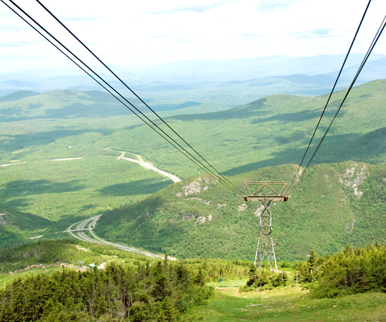
View north from Mt. Washington, the highest point in the Eastern United States, White Mountain National Forest, New Hampshire. View north from Mt. Washington, the highest point in the Eastern United States, White Mountain National Forest, New Hampshire.
Climate
The climate, a continental forest type, is characterized by warm summers. Because maritime air masses have year-round access to the eastern seaboard, precipitation is evenly distributed throughout the year, distinguishing this climate from that of the Laurentian Mixed Forest Province. To the west and north, well-defined summer maximum and winter minimum temperatures reflect the predominance of tropical air masses in summer and continental-polar air masses in winter. Winter can be severely cold, as in Wisconsin, but is less so closer to the ocean. Average annual temperatures range from 37 to 52F (3 to 11C). The average length of the frost-free period is about 100 days. Precipitation in Albany, New York, averages 35 in (890 mm) per year. Average annual snowfall is more than 100 in (2,550 mm).
Vegetation
This mountainous region is in the transition zone between the boreal spruce-fir forest to the north and the deciduous forest to the south. Growth form and species are very similar to those found to the north, but red spruce tends to replace white spruce. Vertical vegetational zonation is present. Valleys contain a hardwood forest where the principal trees are sugar maple, yellow birch, and beech, with an admixture of hemlock. Low mountain slopes support a mixed forest of spruce, fir, maple, beech, and birch. The compensating effect of latitude is apparent in the altitudinal limits of zonation, which rise in elevation as one moves south: the approximate lower limit of spruce and fir on Mt. Katahdin is 500 ft (150 m); in the White Mountains, about 2,500 ft (800 m); in the Adirondack Mountains, 3,000 ft (900 m); and in the Catskills, 3,500 ft (1,100 m). Above the mixed-forest zone lie pure stands of balsam fir and red spruce, which devolve into krummholz at higher elevations. Above timberline on Mount Washington, there is tundralike growth called alpine meadow.
Soils
Most soils are Spodosols that are stony, cool, and moist.
Fauna
This community shares some species with both the Laurentian Mixed Forest and boreal forest, but some species are unique to its alpine tundra, such as longtail shrew, boreal (southern) redback vole, gray-cheeked thrush, spruce grouse, and gray jay.
Data Source: United States Department of Agriculture, Forest Service
Province 221, part of the HUMID TEMPERATE DOMAIN
Eastern Broadleaf Forest (Oceanic)
Appalachian Plateaus, New England lowlands, mid-Atlantic coastal plain, Piedmont Plateau, 104,500 mi2 (270,700 km2)
Land-surface form
This province includes topography of diverse nature and origin. The northern part has been glaciated. West of the Appalachian Mountains are the Appalachian Plateaus. The sedimentary formations there are nearly horizontal, a typical plateau structure, but they are so elevated and dissected that the landforms are mostly hilly and mountainous. Altitudes range from about 1,000 ft (300 m) along their western edge to somewhat more that 3,000 ft (900 m) on the eastern edge. East of the mountains is the Piedmont Plateau and coastal plain, where altitudes range from sea level to about 1,000 ft (300 m).
A grove of yellow-poplar A grove of yellow-poplar in the Eastern Broadleaf Forest (Oceanic) Province, Chattahoochee National Forest, Georgia.
Climate
The continental climatic regime here ensures a strong annual temperature cycle, with cold winters and warm summers. Average annual temperatures range from 40 to 60F (4 to 15C). There is year-round precipitation, averaging from 35 to 60 in (890 to 1,530 mm) per year. Precipitation is markedly greater in the summer months, when evapotranspiration is great and moisture demands are high. Only a small water deficit is incurred in summer, whereas a large surplus normally develops in spring.
Vegetation
This province is characterized by a winter deciduous forest (sometimes called temperate deciduous forest) dominated by tall broadleaf trees that provide a dense, continuous canopy in summer and shed their leaves completely in winter. Lower layers of small trees and shrubs develop weakly. In spring, a luxuriant ground cover of herbs quickly develops, but is greatly reduced after trees reach full foliage and shade the ground. Forest vegetation is divided into three major associations: mixed mesophytic, Appalachian oak, and pine-oak.
Mixed mesophytic vegetation, the deciduous forest with the greatest diversity, occupies moist, well-drained sites in the Appalachian Plateaus. Widespread dominants include American beech, tuliptree (also called yellow-poplar), several basswoods, sugar maple, sweet buckeye, red oak, white oak, and eastern hemlock, in addition to 20-25 other species. The best indicators of this association are buckeye and basswood.
The Appalachian oak association occurs east of the mountains. The dominant species are white oak and northern red oak. Chestnut formerly was abundant, but a blight has destroyed most of this species.
Pine-oak forest--sometimes called "Pine Barrens"--occupies dry sandy soils that are frequently exposed to naturally occurring fires along the northern Coastal Plain. There is a thick shrub layer beneath the pines. Atlantic white-cedar swamps occur on mesic sites.
Soils
The pedogenic process associated with deciduous forest is podzolization, moderated by warm wet winters. As a result, soils are characteristically Alfisols. Toward lower latitudes, the tendency to laterization becomes stronger and Ultisols are encountered. Inceptisols are found on the plateaus. In the deciduous forests, a thick layer of leaves covers the ground and humus is abundant.
Fauna
Important mammals include the whitetail deer, black bear, bobcat, gray fox, raccoon, gray squirrel, fox squirrel, eastern chipmunk, white-footed mouse, pine vole, shorttail shrew, and cotton mouse.
Bird populations are large. The turkey, ruffed grouse, bobwhite, and mourning dove are game birds in various parts of the province. The most abundant breeding birds include the cardinal, tufted titmouse, wood thrush, summer tanager, red-eyed vireo, blue-gray gnatcatcher, and Carolina wren.
Characteristic reptiles include the box turtle, common garter snake, and timber rattlesnake.
Data Source: United States Department of Agriculture, Forest Service
Province 222, part of the HUMID TEMPERATE DOMAIN
Eastern Broadleaf Forest (Continental)
East-Central Drift and Lake-Bed Flats, Ozark Highlands, eastern interior uplands and basins, 270,000 mi2 (699,300 km2)
Land-surface form
Most of the area is rolling, but some parts are nearly flat and in the Ozark Highlands the relief is moderate (up to 1,000 ft [300 m]). Low rolling hills, dissected plateaus, and basins are found in Tennessee and Kentucky. The northern parts of the province have been glaciated, but not the southern. Elevations range from 80 to 1,650 ft (24 to 500 m).
Rolling surface of a glaciated plain Rolling surface of a glaciated plain in central Minnesota. (Photo: Soil Conservation Service.)
Climate
The climate has many characteristics in common with the oceanic broadleaf forest to the east, but precipitation decreases in quantity and effectiveness as one moves inland. Average annual temperatures range from 40F (4C) in the north to 65F (18C) in the south. Summers are hot, with frequent tornadoes. Precipitation varies from 20 in (510 mm) near the 95th meridian to 40 in (1,020 mm) in Ohio, and to 50 in (1,280 mm) in Tennessee. Most precipitation takes place during the growing season.
Vegetation
Like its counterpart to the east, this province is dominated by broadleaf deciduous forest, but the smaller amounts of precipitation found here favor the drought-resistant oak-hickory association. Although other forests have oak and hickory, only this particular forest association has both species in abundance.
The oak-hickory forest is medium-tall to tall, becoming savannalike in its northern reaches from eastern Oklahoma to Minnesota, where it gradually turns into prairie (described below for the Prairie Parkland [Temperate] Province). From eastern Kansas to Indiana, it forms a mosaic pattern with prairie. Widespread dominants are white oak, red oak, black oak, bitternut hickory, and shagbark hickory. The understory is usually well developed, often with flowering dogwood. Other understory species include sassafras and hophornbeam. The shrub layer is distinct, with some evergreens. Many wildflower species occur. Wetter sites typically feature an abundance of American elm, tuliptree, and sweet gum.
Northern reaches of the oak-hickory forest contain increasing numbers of maple, beech, and basswood. The maple-basswood forest, dominated by sugar maple and American basswood, occurs from central Minnesota south through Wisconsin and northeastern Iowa. Glaciated areas of Ohio and Indiana feature a beech-maple forest defined by American beech and sugar maple. In these latter associations, oak and hickory occur on poor sites.
Soils
As in the oceanic broadleaf forest, the soils change from Alfisols in the north to Ultisols in southerly latitudes. Toward the continental interior, calcification sets in as forest soils give way to the darker soils of the grasslands (Mollisols).
Fauna
In the oak-hickory forest, acorns and hickory nuts provide abundant food for the ubiquitous gray squirrel. Fox squirrels are often found, as are eastern chipmunks.
Roving flocks of blue jays also feed on forest nuts. In summer, scarlet and/or summer tanagers, rose-breasted grosbeaks, and ovenbirds are common. The wild turkey is also found here. The cerulean warbler is common in the beech-maple forest, and occurs elsewhere as well.
Data Source: United States Department of Agriculture, Forest Service
Province M221, part of the HUMID TEMPERATE DOMAIN
Central Appalachian Broadleaf Forest--Coniferous Forest--Meadow

Appalachian Highlands, 68,100 mi2 (176,400 km2)
Land-surface form
This province is composed of subdued low mountains of crystalline rocks and open low mountains with valleys underlain by folded strong and weak strata. Some dissected plateaus with mountainous topography are also present. The relief is high (up to 3,000 ft [900 m]). Elevations range from 300 to 6,000 ft (90 to 1,800 m), and are higher to the south, reaching 6,684 ft (2,037 m) at Mount Mitchell, North Carolina.
Gently rounded slopes of the southern Appalachian Mountains, Pisgah National Forest, North Carolina. Gently rounded slopes of the southern Appalachian Mountains, Pisgah National Forest, North Carolina.
Climate
The climate is temperate, with distinct summer and winter, and all areas are subject to frost. Average annual temperatures range from below 50F (10C) in the north to about 64F (18C) at the south end of the highlands. The average length of the frost-free period is about 100 days in the northern mountains, and about 220 days in the low southern parts of the Appalachian Highlands. Average annual precipitation varies from 35 in (890 mm) in the valleys to up to 80 in (2,040 mm) on the highest peaks--the highest in the Eastern United States. Precipitation is fairly well distributed throughout the year (see Appendix 2, climate diagram for Boone, North Carolina). Snowfall is more than 24 in (610 mm) in Pennsylvania, increasing southward along the mountains to about 30 in (770 mm) in the Great Smoky Mountains. Southeast- and southfacing slopes are notably warmer and drier than northwest- and northfacing slopes, because they face the sun and are on the lee side of the ridges. One result is that forest fires are more frequent on southfacing slopes.
Vegetation
Vertical zonation prevails, with the lower limits of each forest belt rising in elevation toward the south. The valleys of the southern Appalachian Mountains support a mixed oak-pine forest that resembles its counterpart on the coastal plains (described below for the Southeastern Mixed Forest Province). Above this zone lies the Appalachian oak forest, dominated by a dozen species each in the white oak and black oak groups. Chestnut was once abundant, but a blight has eliminated it as a canopy tree. Above this zone lies the northeastern hardwood forest, composed of birch, beech, maple, elm, red oak, and basswood, with an admixture of hemlock and white pine. Spruce-fir forest and meadows are found on the highest peaks of the Allegheny and Great Smoky Mountains. Mixed mesophytic forest extends into narrow valleys (coves) of the southern Appalachians, where oak vegetation predominates.
The pattern of vegetation is complicated by topography and substrate. For example, the forests of the Great Smoky Mountains range from open oak and southern pine stands on drier, warmer slopes at low elevations to northern coniferous forests of spruce and fir on cold, moist slopes higher up. But southern pine stands reach up along exposed ridges, and hemlock forest extends down into protected ravines where moisture and local temperature conditions resemble those found at higher elevations.
Soils
Ultisols are found on ridge crests, in areas of gentle topography, and in intermountain basins. Soils on steeper landforms are Inceptisols.
Fauna
The southern limit of distribution of many northern forest mammals coincides with the boundaries of this province. Species distribution maps show fingers of distribution for many species running southward along the crest of the Appalachians. But many species are being confined to scattered areas at higher elevations as forests are cleared or lost due to spruce-fir die-off. The black bear, widely distributed in other parts of North America, occurs quite commonly in the Appalachians and surrounding areas. The eastern cougar, once an important predator, is now thought to be extinct. Whitetail deer are very common.
At upper elevations in extensions of boreal forest, red-breasted nuthatches, black-throated green warblers, golden-crowned warblers, golden-crowned kinglets, and northern juncos forage in red spruce and Fraser fir trees. In the hardwood forests, there are crow-sized pileated woodpeckers, downy, hairy, and red-bellied woodpeckers, common flickers, and wild turkeys. The understory, especially in areas with rhododendrons and azaleas, hosts worm-eating warblers, and the brilliant hooded warbler is found in lush undergrowth. Louisiana waterthrush patrol the streamsides. The mixed mesophytic forest in coves supports a large variety of nesting birds, including the wood thrush, ovenbird, summer tanager, rose-breasted grosbeak, and all the other species already named. The passenger pigeon, once abundant, is now extinct.
Unique to the region is its great variety of salamanders: 27 species inhabit the southern Appalachians--more than any other part of North America.
Data Source: United States Department of Agriculture, Forest Service
Province M222, part of the HUMID TEMPERATE DOMAIN
Broadleaf Forest--Meadow
Ozark Highlands, 6,400 mi2 (16,600 km2)
Land-surface form
This is an area of low dissected mountains composed of sandstone and shale, with altitudes up to 2,000 ft (600 m) and a relief of 1,500 ft (460 m). Valleys are narrow, with steep sides and gradients.
Climate
The climate is hot continental, with cold winters and hot summers. Rainfall occurs throughout the year, with drier periods in summer and autumn. In Mountain Home, Arkansas (on the outskirts of this province), the average annual temperature is 59F (15C) and the average annual precipitation is 41 in (1,050 mm).
Vegetation
This region supports oak-hickory forest. The primary overstory species are red oak, white oak, and hickory. Shortleaf pine and eastern redcedar are important on disturbed sites, shallow soils, and south- and westfacing slopes.
Soils
The major soils are warm, moist Ultisols.
Fauna
No bird or mammal species is uniquely abundant in this province and not in neighboring ones. Bird and mammal communities are similar to those in the Eastern Broadleaf Forest (Continental) Province. Several endemic salamanders, however, are found here.
Data Source: United States Department of Agriculture, Forest Service
Province 231, part of the HUMID TEMPERATE DOMAIN
Southern Mixed Forest
Southeastern United States, 193,000 mi2 (499,900 km2)
Land-surface form
This province comprises the Piedmont and the irregular Gulf Coastal Plains, where 50 to 80 percent of the area slopes gently toward the sea. Local relief is 100 to 600 ft (30 to 180 m) on the Gulf Coastal Plains, and 300 to 1,000 ft (90 to 300 m) on the Piedmont. The flat coastal plains have gentle slopes and local relief of less than 100 ft (30 m). Most of the numerous streams in the region are sluggish; marshes, lakes, and swamps are numerous.
A stand of oak and pine A stand of oak and pine in the Southeastern Mixed Forest Province.
Climate
The climate is roughly uniform throughout the region. Mild winters and hot, humid summers are the rule; the average annual temperature is 60 to 70F (15 to 21C). The growing season is long (200 to 300 days), but frost occurs nearly every winter. Precipitation, which averages from 40 to 60 in (1,020 to 1,530 mm) annually, is rather evenly distributed throughout the year, but peaks slightly in midsummer or early spring, when it falls mostly during thunderstorms. Precipitation exceeds evaporation, but summer droughts occur. Snow falls rarely and melts almost immediately.
Vegetation
Climax vegetation is provided by medium-tall to tall forests of broadleaf deciduous and needleleaf evergreen trees. At least 50 percent of the stands are made up of loblolly pine, shortleaf pine, and other southern yellow pine species, singly or in combination. Common associates include oak, hickory, sweetgum, blackgum, red maple, and winged elm. The main grasses are bluestem, panicums, and longleaf uniola. Dogwood, viburnum, haw, blueberry, American beautyberry, youpon, and numerous woody vines are common. The West Gulf Coast is bordered along its shores by salt marshes characterized by the marsh grass Spartina.
Soils
Ultisols dominate throughout the region, with locally conspicuous Vertisols formed from marls or soft limestones. The Vertisols are clayey soils that form wide, deep cracks when dry. Inceptisols on floodplains of the major streams are among the better soils for crops.
Fauna
Fauna vary with the age and stocking of timber stands, percent of deciduous trees, proximity to openings, and presence of bottom-land forest types. Whitetail deer and cottontail rabbits are widespread. When deciduous trees are present on uplands, the fox squirrel is common. Gray squirrels live along intersecting drainages. Raccoon and fox inhabit the whole region and are hunted in many areas. Among mammals frequently encountered in the western part of this province is the nine-banded armadillo.
The eastern wild turkey, bobwhite, and mourning dove are widespread. Of the 20-odd bird species present in mature forest, the most common are the pine warbler, cardinal, summer tanager, Carolina wren, ruby-throated hummingbird, blue jay, hooded warbler, eastern towhee, and tufted titmouse. The red-cockaded woodpecker is an endangered species.
Forest snakes include cottonmouth moccasin, copperhead, rough green snake, rat snake, coachwhip, and speckled kingsnake. Fench and glass lizards are also found, as is the slimy salamander.
Data Source: United States Department of Agriculture, Forest Service
Province 232, part of the HUMID TEMPERATE DOMAIN
Outer Coastal Plain Mixed
Atlantic and Gulf Coastal Plains, Florida, 173,800 mi2 (450,100 km2)
Land-surface form
This province comprises the flat and irregular Atlantic and Gulf Coastal Plains down to the sea. Well over 50 percent of the area is gently sloping. Local relief is less than 300 ft (90 m), although some areas are gently rolling. Most of the region's numerous streams are sluggish; marshes, swamps, and lakes are numerous.
A forest of live oak draped with Spanish moss A forest of live oak draped with Spanish moss in the Outer Coastal Plain Mixed Forest Province.
Climate
The climate regime is equable, with a small to moderate annual temperature range. Average annual temperature is 60 to 70F (16 to 21C). Rainfall is abundant and well distributed throughout the year; precipitation ranges from 40 to 60 in (1,020 to 1,530 mm) per year.
Vegetation
Temperate rainforest, also called temperate evergreen forest or laurel forest, is typical in this province. Temperate rainforest has fewer species of trees than its equatorial or tropical counterparts, and hence larger populations of individual species. Trees are not as tall here as in low-latitude rainforests; leaves are usually smaller and more leathery, and the leaf canopy less dense. Common species include evergreen oaks and members of the laurel and magnolia families. There is usually a well-developed lower stratum of vegetation that may variously include tree ferns, small palms, shrubs, and herbaceous plants. Lianas and epiphytes are abundant. At higher elevations, where fog and clouds persist, the trunks and branches of trees are often sheathed in moss. A striking example of epiphyte accumulation at lower elevations is the Spanish "moss" that festoons the Evangeline oak, baldcypress, and other trees of the eastern Gulf coast.
Along the Atlantic coast, the extensive coastal marshes and interior swamps are dominated by gum and cypress. Most upland areas are covered by subclimax pine forest, which has an understory of grasses and sedges called savannas. Undrained shallow depressions in savannas form upland bogs or pocosins, in which evergreen shrubs predominate.
A word about the vegetation of the coastal Southeastern United States may prevent some misunderstanding. On forest maps of the United States and on numerous maps of world vegetation, this coastal zone is shown as having needleleaf evergreen or coniferous forest. It is true that sandy uplands have forests of loblolly and slash pine, and that baldcypress is a dominant tree in swamps; but such vegetation represents either xerophytic and hydrophytic forms in excessively dry or wet habitats, or second-growth forest following fire and deforestation. The climax vegetation of mesophytic habitats is the evergreen-oak and magnolia forest.
Soils
Soils are mainly Ultisols, Spodosols, and Entisols. Temperate rainforest grows on a wide variety of upland soils, but most tend to be wet, acidic, and low in major plant nutrients. The soils are derived mainly from coastal plain sediments ranging from heavy clay to gravel, with sandy materials predominant. Silty soils occur mainly on level expanses. Sands are prevalent in hilly areas, but they also cover broad flats in central Florida.
Fauna
This region provides habitat for a wide variety of animals. Except for a few isolated areas where black bear or the endangered Florida panther are found in small numbers, the whitetail deer is the only large indigenous mammal. Common small mammals include raccoons, opossums, flying squirrels, rabbits, and numerous species of ground-dwelling rodents.
Bobwhite and wild turkey are the principal game birds. Migratory nongame bird species are numerous, as are migratory waterfowl. Winter birds are are diverse and numerous. The red-cockaded woodpecker is an endangered species.
Of the numerous species of reptiles found in this province, the American alligator is the largest.
Data Source: United States Department of Agriculture, Forest Service
Province 234, part of the HUMID TEMPERATE DOMAIN
Lower Mississippi Riverine Forest
Lower Mississippi River floodplain, 44,300 mi2 (114,700 km2)
Land-surface form
The province consists of flat to gently sloping broad floodplain and low terraces made up of alluvium and loess. From near sea level in the south, altitude increases gradually to about 660 ft (200 m) in the north. Most of the area is flat, with an average southward slope of less than 8 in/mi (127 mm/km). The only noticeable slopes are sharp terrace scarps and natural levees that rise sharply to several meters above adjacent bottom lands or stream channels. This is the land of oxbow lakes--the cutoff meanders. Swamps are significant in the extreme southern part of Louisiana.
Virgin bald cypress growing in grassy lake Virgin bald cypress growing in grassy lake in Arkansas.
Climate
The climate is similar to that found in adjoining parts of the Subtropical Division. Winters are warm, with temperatures ranging from 50 to 60F (10 to 16C), and summers are hot, with temperatures ranging from 70 to 80F (21 to 27C). Rain falls throughout the year, with a minumum in autumn. Temperature and precipitation decrease as one moves northward. At Natches, Mississippi, average temperatures for January and August are about 50F (10C) and 75F (24C), respectively. Average annual precipitation is 55 in (1,400 mm). Snowfall is negligible. Farther north, at Cairo, Illinois, average temperatures for January and August are about 41F (5C) and 77F (25C), respectively. Average annual precipitation is 43 in (1,100 mm).
Vegetation
Before cultivation, this area was covered by bottom-land deciduous forest with an abundance of green and Carolina ash, elm, cottonwood, sugarberry, sweetgum, and water tupelo, as well as oak and baldcypress. Pecan is also present, associated with eastern sycamore, American elm, and roughleaf dogwood. Vines are prolific along water courses.
Soils
The soils are a mosaic of Inceptisols (in alluvial bottom land), Alfisols (in areas of loess), and Mollisols (in areas with swampy vegetation).
Fauna
Among the numerous bird species found here are the prothonotary warbler, white-eyed vireo, wood duck, yellow-billed cuckoo, Louisiana waterthrush, and all the species found in the Southeastern Mixed Forest.
Data Source: United States Department of Agriculture, Forest Service
Province M231, part of the HUMID TEMPERATE DOMAIN
Ouachita Mixed Forest--Meadow
Ouachita Highlands, 8,800 mi2 (22,800 km2)
Land-Surface Form
The fold mountains here were eroded from sedimentary rock formations compressed into great folds; the upturned edges of the resistant formations form the mountain ridges. The linear ridges reach maximum altitudes of about 2,600 ft (790 m), about 1,500 ft (460 m) above the adjoining valleys. The folds and the mountains trend east-west.
Mixed forest of the Ouachita Mountains, Hot Springs, Arkansas. Mixed forest of the Ouachita Mountains, Hot Springs, Arkansas. (Photo: National Park Service.)
Climate
The climate is similar to that found in adjoining parts of the Subtropical Division. Winters are warm and summers hot. Rain falls throughout the year, but summers are relatively dry. On the outskirts of this province, in Fort Smith, Arkansas, the average annual temperature is 63F (17C). Average annual precipitation is 41 in (1,050 mm).
Vegetation
The area supports oak-hickory-pine forests. The primary overstory species are southern red oak, black oak, white oak, and hickories. Pine constitutes as much as 40 percent of the cover (shortleaf pine in the uplands, with loblolly pine on lower lying alluvial soils). The dry sandstone ridges of the Ouachita Mountains are covered on their southern slopes by a mixture of shortleaf pine, oak, and hickory, and on their northern slopes by hardwood forests made up mainly of oak and hickory. Hardwoods populate the rich bottom lands of the valleys, and pines predominate on poorer lands.
Soils
The major soils are Ultisols. They are stony and nonstony, with medium textures.
Fauna
Bird and mammal species are similar to those found in the surrounding Southeastern Mixed Forest. One amphibian, the Ouachita dusky salamander, is found exclusively in this province's rocky, gravelly streams.
Data Source: United States Department of Agriculture, Forest Service
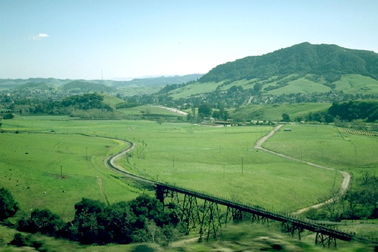
Province 242, part of the HUMID TEMPERATE DOMAIN
Pacific Lowland Mixed Forest
Puget-Willamette Lowland, 14,900 mi2 (38,600 km2)
Land-Surface Form
The Pacific Lowland Mixed Forest occupies a north-south depression between the Coast Ranges and the Cascade Mountains. Elevations range from sea level to 1,500 ft (460 m). The Willamette Valley has nearly level to gently sloping floodplains bordered by dissected high terraces and hills. The Puget Sound Valley is a moderately dissected tableland covered by glacial till, glacial outwash, and lacustrine deposits. This province includes isolated hills and low mountains.
Climate
Because this province is close to the Pacific Ocean, its climate is generally mild throughout the year. Annual temperatures average 48 to 55F (9 to 13C). The moderate rainfall reaches its maximum in winter; summer has a slight moisture deficit. Average annual rainfall ranges from 15 to 60 in (380 to 1,530 mm); but in much of the area, the range is from 30 to 45 in (760 to 1,150 mm). Coastal mountains are responsible for the drier and less muted climate. Fog partially compensates for the summer drought.
Vegetation
Before cultivation, dense coniferous forest dominated the vegetation here. Principal trees are western redcedar, western hemlock, and Douglas-fir. In interior valleys, the coniferous forest is less dense than along the coast and often contains deciduous trees, such as big-leaf maple, Oregon ash, and black cottonwood. There are prairies that support open stands of oaks or are broken by groves of Douglas-fir and other trees; principal indicator species are Oregon white oak and Pacific madrone. Poorly drained sites with swamp or bog communities are abundant.
Soils
Alfisols, Inceptisols, and Ultisols are the principal soil orders. Inceptisols dominate in Puget Sound Valley.
Fauna
The fauna are closely related to those of the surrounding Cascade Province (described below). Mule deer is the most common large mammal. Chief mammalian predators are the mountain lion and bobcat. The western gray squirrel lives in oak trees, and the bushytail wood rat builds nests on shrub-covered stream margins and at forest edges. Isolated thickets are inhabited by brush rabbit and gray fox.
Ruffed grouse inhabit the same scattered thickets. The dusky Canada goose winters exclusively in the Willamette Valley in Oregon. The periodically abundant acorn crop attracts flocks of band-tailed pigeons, acorn woodpeckers, and mountain quail.
The dry terrain is ideal for reptiles, including the northern Pacific rattlesnake, the only poisonous snake in the Pacific Northwest.
Data Source: United States Department of Agriculture, Forest Service
Province M242, part of the HUMID TEMPERATE DOMAIN
Cascade Mixed Forest--Coniferous Forest--Alpine Meadow
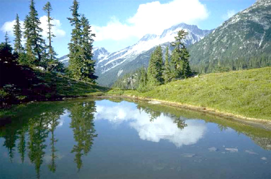
Pacific Northwest, 53,400 mi2 (138,300 km2)
Land-surface form
The Cascade Province covers a series of steep, rugged mountains bordered in places by a narrow coastal plain. Mountains along the coast rise 5,000 ft (1,500 m) above sea level, with a local relief of 1,000-3,000 ft (300-900 m). The interior Cascade Range has mountains 8,000-9,000 ft (2,400-2,700 m) in altitude, dominated every 5-85 mi (8-135 km) by a volcano of much higher elevation. Mt. Rainier, for example, rises more than 14,000 ft (4,300 m) above sea level. Some parts of the province, especially its northern portion and the Cascade Range, have been glaciated.
Western hemlock and Sitka spruce in the Cascade Province, Olympic National Forest, Washington. Western hemlock and Sitka spruce in the Cascade Province, Olympic National Forest, Washington.
Climate
Because this province borders on the Pacific Ocean, its climate is characterized by generally mild temperatures averaging 35 to 50F (2 to 10C) throughout the year. Rainfall is heavy, 30 to 150 in (770 to 3,800 mm) per year, with a maximum in winter. Humidity is always high, producing an extremely favorable precipitation/evaporation ratio. The southern part of this province is winter-wet with no snow; fog partially compensates for the summer drought. As one moves to the north, the summer dry season shortens, and the proportion of precipitation falling as snow increases. On high mountains, all precipitation may be snow, which reaches depths of 50 to 65 ft (15 to 20 m). East slopes are much drier than west slopes, accumulating less than 20 in (511 mm) of precipitation per year.
Vegetation
The Cascade Province is primarily montane, but it ranges from sea level to altitudes above 5,000 ft (1,500 m). At the lowest elevations, there is a dense conifer forest of Douglas-fir, western redcedar, western hemlock, grand fir, silver fir, Sitka spruce, and Alaska-cedar. Numerous species of shrubs grow exceptionally well in this forest and around its margins. In many places, this vegetation is practically impenetrable.
Although Douglas-fir is the most abundant tree at lower elevations in the region, it is not part of the climax forest. Western hemlock and several other species of fir are more tolerant of shade than Douglas-fir, and in mature forest stands, Douglas-fir cannot regenerate. On the western and southern slopes of the Olympic Mountains in Washington, hemlock is eventually displaced by the more shade-tolerant silver fir.
In the humid conifer forests of southwestern Oregon, Alaska-cedar is replaced by silver fir and redwood. In the fog belt along the coast of northwestern California, redwood is the characteristic tree. Douglas-fir and other conifers associate with it to form perhaps the densest of all coniferous forests, with the world's largest trees. Some redwoods attain heights of more than 325 ft (99 m) and girths of more than 65 ft (19.8 m).
A xerophytic forest of ponderosa pine grows along the dry eastern slopes of the Cascades, descending to 500 ft (150 m) along the eastern foot of the range at the Columbia River. This is typically open forest mixed with grass and shrubs. It occurs throughout the Southwest, the Sierra Nevada, the Rocky Mountains, and the Black Hills.
An open, parklike stand of ponderosa pine, Deschutes National Forest, Oregon. An open, parklike stand of ponderosa pine, Deschutes National Forest, Oregon.
The high, snowcapped mountains of the Cascades have a well-marked subalpine forest belt that reaches into British Columbia. Important trees are mountain hemlock, subalpine fir, whitebark pine, and Alaska-cedar. To the north, the subalpine forest becomes fragmentary or disappears completely.
All but the highest peaks are covered by forest. In the Cascade Mountains of Oregon, timberline varies from 7,700 to 10,000 ft (2,350 to 3,050 m). Above timberline, there is an alpine zone with rich communities of shrubs and herbs. Perpetual snow is confined to small patches.
Riparian forests in the Pacific Northwest are an exception to the general rule that conifers dominate in the region. Along the region's many rivers and streams, needleleaf trees are replaced by broadleaf species such as black cottonwood and red alder. This kind of forest occurs from southern Alaska south through Washington, Oregon, Idaho, and western Montana, continuing into northern California and the Sierra Nevada.
Soils
Andisols are extensive where underlain by volcanic ash. Moist Inceptisols are found west of the Cascades; dry soils predominate in the rain shadow east of the mountains.
Fauna
Common large mammals include elk, deer, mountain lion, bobcat, and black bear. Small mammals include mice, Douglas squirrels, martens, Townsend chipmunks, red tree voles, and bushytail wood rats.
The more common birds are the winter wren, Townsend's warbler, chestnut-backed chickadee, red-breasted nuthatch, gray jay, and Steller's jay. The most important game birds are blue and ruffed grouse; there are hawks and owls in the northwestern part of the province. Spotted owl and marbled murrelet depend on remaining old-growth forests.
Among the many species of amphibians that live in this region's moist, cool forests are the Pacific treefrog and the Pacific giant salamander. Reptiles include the northern alligator lizard and rubber boa.
The many swift-flowing rivers of the region are high in dissolved oxygen and generally unpolluted, making them ideal habitats for various salmon and trout species.
Data Source: United States Department of Agriculture, Forest Service
Province 251, part of the HUMID TEMPERATE DOMAIN
Prairie Parkland (Temperate)
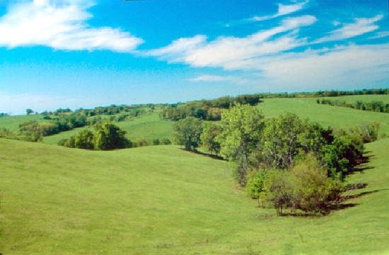
Central lowlands, 218,200 mi2 (565,100 km2)
The irregular surface of the Prairie Parkland Province Land-surface form
The Prairie Parkland (Temperate) Province covers an extensive area from Canada to Oklahoma, with alternating prairie and deciduous forest. The topography is mostly gently rolling plains, but steep bluffs border a number of valleys. Some areas are nearly flat; others have high rounded hills. Elevations range from 300 to 2,000 ft (90 to 600 m). The far northern portion of the province has been glaciated.
The irregular surface of the Prairie Parkland Province in northeastern Kansas, on the proposed site of Prairie National Park. (Photo: National Park Service.)
Climate
Summers are usually hot, and winters are cold, especially in the northern part of the province. Average annual temperatures may reach 40F (4C) in the north and 60F (16C) in the south. Winters are short and relatively mild in southerly areas. The frost-free season ranges from 120 days along the northern fringe to 235 days in the south. Average annual precipitation ranges from 20 to 40 in (510 to 1,020 mm), falling mainly during the growing season.
Vegetation
Vegetation in this province is forest-steppe, characterized by intermingled prairie, groves, and strips of deciduous trees. The alternation of forest and prairie in the western part of the province results chiefly from local soil conditions and slope exposure; trees are commonly found near streams and on northfacing slopes. The thin soils atop this area's limestone hills support very few trees. In the eastern part of the province, however, trees often cover the highest hills. The prairies seem to be areas that have not yet become forested, either because of frequent fires or because the last glaciation was too recent for final successional stages to have been reached.
Grasses are the dominant prairie vegetation. Most are moderately tall and usually grow in bunches. The most prevalent type of grassland is bluestem prairie, dominated by such plants as big bluestem, little bluestem, switchgrass, and Indian grass, along with many species of wildflowers and legumes. In many places where grazing and fire are controlled, deciduous forest is encroaching on the prairies. Due to generally favorable conditions of climate and soil, most of the area is cultivated, and little of the original vegetation remains.
The upland forest in this province is dominated by oak and hickory, forming part of the oak-hickory forest described above for the Eastern Broadleaf Forest (Continental) Province. On floodplains and moist hillsides, the deciduous forest is richer. In the western part of the province, it includes eastern cottonwood, black willow, and American elm.
Floodplain forest of cottonwood Floodplain forest of cottonwood in Nebraska.
Soils
Mollisols dominate throughout the province. Alfisols are found in the Mississippi Valley.
Fauna
In addition to prairie animals that do not need woody vegetation, many forest animals are found in this province. They inhabit the wooded valleys that extend westward across the region.
Few forms are peculiar to the region, but certain mammals are indicative of its riverine forests, including mink and river otter. On the prairies, thirteen-lined ground squirrels and blacktail prairie dogs are commonly seen.
Birds of the riverine forests include the belted kingfisher, bank swallow, spotted sandpiper, and green-backed heron. Upland birds include the horned lark, eastern meadowlark, and mourning dove.
Data Source: United States Department of Agriculture, Forest Service
Province 255, part of the HUMID TEMPERATE DOMAIN
Prairie Parkland (Subtropical)
West Gulf Coastal Plain, central lowlands, 80,100 mi2 (207,500 km2)
An oak Savanna Land-Surface Form
This province is a region of gently rolling to flat plains, many of them part of the Gulf Coastal Plain. Over 50 percent of the area is gently sloping. Elevations range from sea level to 1,300 ft (400 m), with a local relief of less than 300 ft (90 m). Most of the Coastal Plain streams and rivers are sluggish; there are numerous wetland areas along the coast.
An oak savanna in Texas. Overgrazed area on left has been invaded by prairie coneflower. (Photo: Soil Conservation Service.)
Climate
The climate is similar to that of the temperate prairies described above, except that winters are warmer and there is more precipitation, mostly in the form of rain instead of snow. Winters are warm (50 to 60F [10 to 16C]) and summers are hot (70 to 80F [21 to 27C]). Average annual precipitation ranges from 35 in (890 mm) in the north to 55 in (1,410 mm) in the south along the coast. Rain falls throughout the year, brought by on-shore winds in summer and by depressions in winter. Hurricanes are frequent in autumn. On the coast, the climate is almost without frost.
Vegetation
This region consists of prairies and savannas. Like the temperate prairies to the north, it is part of the grassland-forest transition area of the central United States. Due to aridity and probably also to fires and grazing, this area is dominated by various short and medium-to-tall grasses, along with a few hardy tree species. Trees are typically evergreen and are widely spaced and short of stature, rarely more than 25 ft (8 m) tall. Post oak and blackjack oak dominate the cross timbers region of Oklahoma and Texas. Hickories are common only in stands near the forest region. Soil is a key factor in local distribution. Fine, heavy soils generally support grassland vegetation, and coarse, lighter soils are covered with stands of savanna.
Bluestem is the principal grass throughout the region. The Gulf Coast of Texas has an extensive border of marshes stretching inland 5 to 10 mi (8 to 16 km), sometimes farther.
Soils
Mollisols, Alfisols, and Vertisols are the dominant soils. Dry Alfisols are found on the savannas, with Mollisols and Vertisols on the prairies.
Fauna
Whitetail deer are abundant, as is the nine-banded armadillo. The red wolf is classified as an endangered species.
The Scissor
Tailed flycatcher, eastern meadowlark, lark sparrow, and eastern and western kingbirds are indicator species of the region.
Data Source: United States Department of Agriculture, Forest Service
Province 261, part of the HUMID TEMPERATE DOMAIN
California Coastal Chaparral Forest Shrub Province
West Gulf Coastal Plain, central lowlands, 80,100 mi2 (207,500 km2)
An oak savanna Land-surface form.--This province is a region of gently rolling to flat plains, many of them part of the Gulf Coastal Plain. Over 50 percent of the area is gently sloping. Elevations range from sea level to 1,300 ft (400 m), with a local relief of less than 300 ft (90 m). Most of the Coastal Plain streams and rivers are sluggish; there are numerous wetland areas along the coast.
An oak savanna in Texas. Overgrazed area on left has been invaded by prairie coneflower. (Photo: Soil Conservation Service.)
Climate
The climate is similar to that of the temperate prairies described above, except that winters are warmer and there is more precipitation, mostly in the form of rain instead of snow. Winters are warm (50 to 60F [10 to 16C]) and summers are hot (70 to 80F [21 to 27C]). Average annual precipitation ranges from 35 in (890 mm) in the north to 55 in (1,410 mm) in the south along the coast. Rain falls throughout the year, brought by on-shore winds in summer and by depressions in winter. Hurricanes are frequent in autumn. On the coast, the climate is almost without frost.
Vegetation
This region consists of prairies and savannas. Like the temperate prairies to the north, it is part of the grassland-forest transition area of the central United States. Due to aridity and probably also to fires and grazing, this area is dominated by various short and medium-to-tall grasses, along with a few hardy tree species. Trees are typically evergreen and are widely spaced and short of stature, rarely more than 25 ft (8 m) tall. Post oak and blackjack oak dominate the cross timbers region of Oklahoma and Texas. Hickories are common only in stands near the forest region. Soil is a key factor in local distribution. Fine, heavy soils generally support grassland vegetation, and coarse, lighter soils are covered with stands of savanna.
Bluestem is the principal grass throughout the region. The Gulf Coast of Texas has an extensive border of marshes stretching inland 5 to 10 mi (8 to 16 km), sometimes farther.
Soils
Mollisols, Alfisols, and Vertisols are the dominant soils. Dry Alfisols are found on the savannas, with Mollisols and Vertisols on the prairies.
Fauna
Whitetail deer are abundant, as is the nine-banded armadillo. The red wolf is classified as an endangered species.
The scissor-tailed flycatcher, eastern meadowlark, lark sparrow, and eastern and western kingbirds are indicator species of the region.
Data Source: United States Department of Agriculture, Forest Service
Province 261, part of the HUMID TEMPERATE DOMAIN
California Coastal Chaparral Forest Shrub
Southern California coast, 10,300 mi2 (26,700 km2)
Land-Surface Form
This province includes the discontinuous coastal plains, low mountains, and interior valleys adjacent to the Pacific Ocean from San Francisco to San Diego. Elevations range from sea level to 2,400 ft (730 m).
Climate
The climate is characterized by hot, dry summers and rainy, mild winters. Annual temperatures average 50 to 65F (10 to 18C). Annual precipitation ranges from 10 to 50 in (260 to 1,280 mm), with a pronounced summer drought. This coastal province has a more moderate climate than the interior and receives some moisture from fog in summer. Fire is common, usually set by lightning during the summer dry season.
Vegetation
Plant communities are well marked in this province. Several tree species are endemic to the region, including the Monterey cypress, Torrey pine, Monterey pine, and Bishop pine. The coastal plains and larger valleys have sagebrush and grassland communities. A riparian forest containing many broadleaf species grows along streams. On the hills and lower mountains, there is sclerophyll forest consisting of low trees with small, leathery leaves that can withstand the lack of summer precipitation. Live oak or white oak woodland is found here. On steep hill and mountain slopes too dry to support oak woodland or oak forest, much of the vegetation is scrub or "dwarf forest" know as chaparral, which varies in composition with elevation and exposure. It consists of chamise and various manzanitas that are adapted to periodic occurrence of fire. Exposed coastal areas support desertlike shrub communities called coastal scrub, dominated by coyote bush, California sagebrush, and bush lupine. Toward southern California, sages become abundant within coastal scrub communities.
Most of the coastal plains and interior valleys have been converted to urban use or irrigated agriculture. Citrus, grapes, avacados, nuts (such as almonds and walnuts), and deciduous fruits are grown extensively. Irrigated alluvial soils are also highly productive of vegetable crops. Bluegum eucalyptus and other species imported from Australia are abundant along roadsides and much of the coastline as well as farther inland.
Soils
The soils of this region are mostly Alfisols and Mollisols. They are high in bases and quite fertile when soil water is adequate.
Fauna
The brushy rabbit is common, as is the opossum, North America's only marsupial. Several species of seals and sea lions live along the California coast, and sea otters often float among kelp, feeding on sea urchins. The blue whale, the world's largest animal species, is found in California's coastal waters.
Coastal California is a major migration route for both water and land birds. From midsummer through winter and spring, thousands of shore birds, ducks, and geese inhabit coastal estuaries, lagoons, and mudflats. Other birds include the lesser goldfinch and golden-crowned sparrow.
Data Source: United States Department of Agriculture, Forest Service
Province 262, part of the HUMID TEMPERATE DOMAIN
California Dry Steppe
Central Valley of California, 19,200 mi2 (47,900 km2)
Land-surface form
This province lies within the Central Valley of California--a flat alluvial plain between the Sierra Nevada and the Coast Ranges. Elevations range from sea level to 500 ft (150 m). This area has broad, nearly level valleys bordered by sloping alluvial fans, slightly dissected terraces and the lower foothills of the surrounding uplands. Large undrained basins lie in the south.
Climate
Annual temperatures in this climate average 60 to 67F (16 to 19C), but can fall as low as 55F (13C) in the south. Precipitation is largely limited to winter rainfall, which peaks in December, January, and February. Except near the coast, summers are hot and the winters mild--often foggy, with little or no snow. Annual rainfall ranges from approximately 6 in (150 mm) in the upper San Joaquin Valley to nearly 30 in (760 mm) along the coast. Potential evaporation during the warmest months is often much greater than the precipitation. Low rainfall and small streamflow result in water scarcity in many areas.
Vegetation
Evidence indicates that the Central Valley of California was once dominated by natural grasses that the plow, fire, and grazing have eliminated except in a few remaining stands. These stands suggest that the dominants were bunch grasses on lands similar in appearance to mixed prairie. Apparently, needlegrass was the principal species except near the coast. Today, introduced annual grasses, including various species of avens, brome, fescue, and barley, occupy most of the remaining grassland areas.
The rivers flow through alkaline flats where greasewood, picklewood, salt grass, and shadscale provide the chief cover. Tule marshes border the lower reaches of the San Joaquin and Sacramento Rivers.
Soils
The soils of this region are mostly Entisols and Alfisols. The Entisols are usually at the lower elevations and the Alfisols at slightly higher elevations, away from the valley floor. A small area of Aridisols occurs in the more arid southern portions of the San Joaquin Valley.
Fauna
Intensive agricultural development has changed the fauna of the annual grasslands. Larger species, such as the California grizzly bear, wolf, and pronghorn antelope, have been eliminated or pushed up into the hills. Common mammals include the Beechy ground squirrel, cottontail, blacktail jackrabbit, California mouse, and kangaroo rats. Several subspecies of mule deer live in brushy areas. Other species, such as the coyote and bobcat, live in adjacent woodlands, occasionally entering from them. The San Joaquin kit fox is classified as an endangered species.
Common birds include the mourning dove, horned lark, western meadowlark, western kingbird, mockingbird, loggerhead shrike, house finch, lesser goldfinch, red-shafted flicker, and scrub jay. The roadrunner feeds on reptiles and insects. The California quail is numerous in areas where brush or rock outcrops provide cover. Avian predators include the golden eagle, red-tailed hawk, and Cooper's hawk.
Several species of snakes and lizards are present; rattlesnakes are important predators on rodents.
Data Source: United States Department of Agriculture, Forest Service
Province 263, part of the HUMID TEMPERATE DOMAIN
California Coastal Steppe, Mixed Forest, and Redwood Forest
Northern California coast, 4,600 mi2 (11,900 km2)
Land-Surface Form
Much of this province is composed of low mountains, but in places there are a narrow coastal plain and gently sloping marine terraces. A few broad valleys extend inland through the mountains. Confined to the coast, this region extends no farther inland than 35 mi (56 km), remaining at elevations below 3,000 ft (900 m).
Virgin redwood forest Virgin redwood forest on Mill Creek, near Crescent City, California.
Climate
Characterized by a cool-summer subtype of the Mediterranean dry-summer subtropical climate, this province is confined to coasts washed by cool currents. The annual temperature cycle is very weak, reflecting the powerful influence of the cold California sea current with its cool marine air layer. Cool summers are typical, and winter temperatures are much milder than those of inland locations at similar latitudes. Annual temperatures average 50 to 55F (10 to 13C). All months are above freezing. Rainfall drops to nearly zero for 2 consecutive summer months, but rises to substantial amounts in the rainy winter season. Annual rainfall ranges from 40 to 100 in (1,020 to 2,550 mm). Heavy fogs are common along the coast in summer. This region has a greater mean number of days with dense fogs than any other place in the United States.
Vegetation
The redwood is characteristic of the fog belt on seaward slopes of coastal northwestern California. Associated with it are Douglas-fir and other conifers such as hemlock and cedar. The redwood forest is a hygrophyllic type of warm-temperate forest. Redwoods, which attain a height of 330 ft (100 m), are taller than the giant sequoia (big tree), which grows only in the Sierra Nevada of California. But redwood trunks remain relatively slender. Although redwoods live 500 years on average, they can reach up to 1,800 years of age. By comparison, 4,000 annual rings have been counted in the trunks of giant sequoia.
Redwood forests typically have a well-developed understory, usually dominated by large and colorful Pacific rhododendrons and western azaleas. Other shrubs, especially salal and California huckleberry, are usually present. Many ferns and flowers grow in the cool shade, such as western sword fern and redwood sorrel.
Headlands tend to be dry, and their outer ends are covered with fescue-oatgrass grasslands. Along the coast in a narrow, patchy belt lies pine-cypress forest. Inland, the southfacing mountain slopes are covered by mixed forest, including tanoak, coast live oak, madrone, and Douglas-fir. Oaks in the area of coastal forest tend to form distinct patches of oak woodland.
Soils
The dominant soils are Ultisols under forest and Mollisols under grasslands.
Fauna
Mule deer are common, and the Roosevelt subspecies of elk can be seen in Redwood National Park. Mammals include both Douglas and western gray squirrels, as well as two chipmunk species.
Birds include Anna's hummingbird and Wilson's warbler. The spotted owl can be found in both old-growth and second-growth redwood forest, along with great horned owls, western screech-owls, and northern pygmy-owls. A variety of shore birds and waterfowl occur in the coastal part of the province. Species of concern include marbled murrelet and northern spotted owl.
Salamanders, such as the Pacific giant salamander, are numerous in the cool, moist litter of the redwoods, especially near streams and rivers. The banana slug is also found here.
Streams and rivers are used by anadromous fish.
Data Source: United States Department of Agriculture, Forest Service
Province M261, part of the HUMID TEMPERATE DOMAIN
Sierran Steppe--Mixed Forest--Coniferous Forest--Alpine Meadow
California and southern Oregon, 68,300 mi2 (176,900 km2)
Land-Surface Form
This province covers the southernmost portion of the Cascade Mountains, the northern Coast Range, the Klamath Mountains, and the Sierra Nevada. Most of the area is covered with steeply sloping to precipitous mountains crossed by many valleys with steep gradients. The long west slope of the Sierra Nevada rises gradually from 2,000 ft (600 m) to more than 14,000 ft (4,300 m); the east slope drops abruptly to the floor of the Great Basin, about 4,000 ft (1,200 m). Much of this region has been glaciated.
Lateral moraines of Green Creek, 10 mi south of Bridgeport, California. View is westward up the east front of the Sierra Nevada. Lateral moraines of Green Creek, 10 mi south of Bridgeport, California. View is westward up the east front of the Sierra Nevada. (Photo: John S. Shelton.)
Climate
Temperatures average 35 to 52F (2 to 11C), but fall with rising elevation. The base of the west slope receives only about 10 to 15 in (250 to 380 mm) of rainfall per year and has a long, unbroken dry summer season. At higher elevations, the dry summer season shortens and precipitation rises to as much as 70 in (1,790 mm), with a larger portion falling as snow. Prevailing west winds influence climatic conditions for the whole region. East slopes are much drier than west slopes (see Appendix 2, climate diagram for Tahoe, California). Winter precipitation makes up 80 to 85 percent of the total; at high elevations, it is mostly snow. The greatest total precipitation reported is on slopes between 3,000 and 7,000 ft (900 and 2,100 m), which support the luxuriant mixed conifer forests of the montane zone. The subalpine zone coincides with the altitude of greatest snowfall, where precipitation is 40 to 50 in (1,020 to 1,280 mm) per year.
Vegetation
Vegetation zones are exceptionally well marked. The lower slopes and foothills, from about 1,500 to 4,000 ft (460 to 1,200 m), are covered by coniferous and shrub associations. On higher slopes, digger pine and blue oak dominate, forming typical open or woodland stands. Most of the low hills are covered by close-growing evergreen scrub, or chaparral, in which buckbrush and manzanita predominate. Several oaks are common associates.
The montane zone lies between about 2,000 and 6,000 ft (600 and 1,800 m) in the Cascades, 4,000 and 7,000 ft (1,200 and 2,100 m) in the Central Sierras, and 5,000 and 8,000 ft (1,500 and 2,400 m) or more in the south. The most important trees are ponderosa pine, Jeffrey pine, Douglas-fir, sugar pine, white fir, red fir, and incense cedar; but several other conifers are also present. The giant sequoia (big tree) is one of the most spectacular species, but it grows only in a few groves on the western slope. Dense chaparral communities of manzanita, buckbrush, and buckthorn may appear after fire, sometimes persisting for years. Within the Sierran rain shadow, on the dry eastern slopes, Jeffrey pine replaces ponderosa pine. At lower elevations, pine forests are replaced by sagebrush-pinyon forest, part of the Intermountain Desert Province.
The subalpine zone begins at from 6,500 ft to 9,500 ft (1,980 m to 2,900 m), depending on latitude and exposure, and extends upslope about 1,000 ft (300 m). Mountain hemlock, California red fir, lodgepole pine, western white pine, and whitebark pine are important. Conditions are severe, and timberline varies from about 7,000 ft (2,100 m) in the north to 10,000 ft (3,000 m) in the south. Lodgepole pine is said to have climax characteristics near the upper limits of this zone.
The alpine zone covers the treeless areas above timberline.
Soils
Ultisols are extensive on mountain slopes where air is humid; dry Alfisols predominate at lower elevations. Entisols occupy the narrow floodplains and alluvial fans of the valleys.
Characteristic open oak woodland of the Sierran foothills, Sequoia National Forest, California. Characteristic open oak woodland of the Sierran foothills, Sequoia National Forest, California.
Fauna
Common large mammals include mule deer, mountain lion, coyote, and black bear. Smaller mammals include golden-mantled squirrel, bushytail wood rat, flying squirrel, red fox, fisher, yellow-haired porcupine, long-eared chipmunk, and Trowbridge's shrew.
Common birds are mountain quail, Cassin's finch, Hammond's flycatcher, Lincoln's sparrow, Audubon's warbler, pine siskin, Oregon junco, blue goose, Williamson's sapsucker, and mountain chickadee. Birds of prey include the western screech-owl, Cooper's hawk, northern pygmy-owl, and great gray owl.
The California mountain kingsnake also lives here.
The bark beetles Ips emarginatus and I. integer infest ponderosa and lodgepole pine.
Data Source: United States Department of Agriculture, Forest Service
Province M262, part of the HUMID TEMPERATE DOMAIN
California Coastal Range Open Woodland--Shrub--Coniferous Forest--Meadow

Southern California, 24,900 mi2 (64,500 km2)
Land-Surface Form
This province occupies the central part of the California Coast Ranges and the mountains of southern California. The Coast Ranges are gently to steeply sloping low mountains underlain by shale, sandstone, and igneous and volcanic rocks. Elevations range from 500 to 2,500 ft (150 to 800 m); some peaks rise to 5,000 ft (1,500 m). Stream valleys are narrow and widely spaced. The mountains of southern California are steeply sloping to precipitous; high mountains have unstable slopes and sharp crests; valleys are narrow. Elevations range from 2,000 to 8,000 ft (600 to 2,400 m); some peaks reach 12,000 ft (3,700 m).
Chaparral (dominated by red shank, ceanothus, and sage) on southern California mountains, with Mt. Palomar in background, Cleveland National Forest. Chaparral (dominated by red shank, ceanothus, and sage) on southern California mountains, with Mt. Palomar in background, Cleveland National Forest.
Climate
The climate is characterized by hot, dry summers and rainy, mild winters. Temperatures average 53 to 65F (12 to 18C) in the Coast Range, but are only 32 to 60F (0 to 16C) in the mountains of southern California, always falling with rising elevation. Precipitation, which ranges from 12 to 40 in (310 to 1,020 mm) per year, is evenly distributed through fall, winter, and spring, and increases with elevation. Most of this is rain; the little snow that falls in winter melts quickly. Frost and short periods of freezing weather occur occasionally in winter. Coastal areas have a more moderate climate than the interior and receive some moisture from fog in summer.
Vegetation
The montane vegetation of this region consists of species with thick, hard evergreen leaves. One climax association, dominated by trees, is called sclerophyll forest. The other, called chaparral, is a shrub climax. These two associations appear in alternating patches in almost every part of the region, but chaparral occupies the greater area. The forest consistently appears on northfacing slopes and on wetter sites; chaparral occupies southfacing slopes and drier sites.
The most important evergreen trees of the sclerophyll forest are California live oak, canyon live oak, interior live oak, tanoak, California laurel, Pacific madrone, golden chinkapin, and Pacific bayberry. Several deciduous trees, shrubs, and herb associates are also characteristic.
The chaparral community of fire-adapted shrubs extends over a wide area with a diversity of habitats. It includes at least 40 species of evergreen shrubs with varying degrees of dominance and importance. Some are so dense that they practically eliminate understory vegetation; other types support a highly productive understory. The most important species are chamise and manzanita. Other common species are Christmasberry, California scrub oak, mountain mahogany, and many species of ceanothus. At higher elevations and near the ocean, chaparral is often interspersed with, or alternates with, coniferous forests.
The interior valleys have sagebrush and grassland communities. A riparian forest with many broadleaf species grows along streams.
Soils
The pattern of Alfisols, Entisols, and Mollisols in this region is complex. Mollisols are usually found along the coast; Alfisols occur in the north; and the south consists mostly of Entisols.
Fauna
Mule deer are the most important large mammals. Other large mammals include the coyote, mountain lion, California bobcat, gray fox, wood rat, and spotted and striped skunks. Small mammals peculiar to chaparral include the Merriam chipmunk, California mouse, and five-toed kangaroo rat.
The most common birds seen in the dry summer season are wrentit, common bushtit, and rufous-sided towhee. In October, white-and-golden-crowned sparrows, several races of fox sparrows, hermit thrushes, ruby-crowned kinglets, and Audubon's warblers are present. The California condor is classified as an endangered species.
Reptiles, including the coast horned lizard and gopher snake, are numerous in all vegetation types. Amphibians appear to be scarce, except for the Pacific treefrog.
Data Source: United States Department of Agriculture, Forest Service
Province 311, Part of the DRY DOMAIN
Great Plains Steppe and Shrub
Oklahoma, 17,600 mi2 (45,600 km2)
Land-surface form
Most of this region is characterized by irregular plains with a relief of less than 300 ft (90 m). Elevations range from 1,600 ft (490 m) to 3,000 ft (900 m), increasing gradually from east to west. On these dissected plains, the broad divides range from nearly level to gently sloping, but slopes are short and steep in the valleys. In southwestern Oklahoma, the Wichita Mountains rise as much as 1,000 ft (300 m) above the surrounding plains.
Climate
The climate is semiarid-subtropical. Although maximum rainfall occurs in summer, high temperatures make summer relatively dry. Average annual temperatures range from 57 to 64F (14 to 18C). Winters are cold and dry, and summers are warm to hot. The frost-free season lasts from 185 to 230 days. Precipitation ranges from 19 to 29 in (490 to 740 mm), with most of it falling as rain.
Vegetation
This region is dominated by tall grasses extending west from the oak savanna of the cross timbers area on the eastern edge of the province. Bluestem-grama prairie covers the finer textured soils characteristic of most of the province. Oak savanna occurs along the east border of the province and along some of the major river valleys. Sandsage-bluestem prairies are dominant on the coarse textured soils near the province's western edge.
Soils
The soils are Mollisols with a minor component of Alfisols.
Fauna
This province shares some species with surrounding provinces. No bird or mammal species is uniquely abundant here.
Data Source: United States Department of Agriculture, Forest Service
Province 313, Part of the DRY DOMAIN
Colorado Plateau Semidesert
Colorado River Plateau, Arizona, New Mexico, Utah, 75,300 mi2 (195,000 km2)
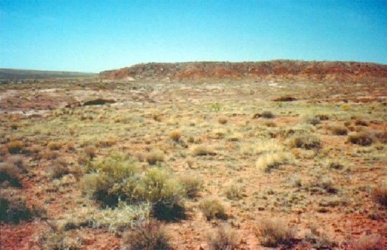
Monument Valley, Arizona Land-surface form.--The Colorado Plateau Province consists of tablelands with moderate to considerable relief in Arizona, New Mexico, and Utah. Elevations of the plateau tops range from 5,000 to 7,000 ft (1,500 to 2,100 m), with local relief ranging from 500 to more than 3,000 ft (150 to 900 m) in some of the deeper canyons that dissect the plateaus (such as the Grand Canyon of the Colorado River). In some areas, volcanic mountains rise 1,000 to 3,000 ft (300 to 900 m) above the plateau surface. Stream valleys are narrow and widely spaced. The Colorado River, which crosses the northern part of the province, is the region's only large stream. Many other streams flow year-round, but the volume of water fluctuates considerably.
Monument Valley, Arizona, a well-defined tableland on the Colorado Plateau. (Photo: John S. Shelton.)
Climate
Due to the region's generally high altitude, the climate is characterized by cold winters. Summer days are usually hot, but nights are cool; accordingly, the diurnal variation in temperature is considerable. Annual average temperatures are 40 to 55F (4 to 13C), decreasing with rising elevation. Average annual precipitation is about 20 in (510 mm), except on the higher mountains; some parts of the province receive less than 10 in (260 mm). Summer rains are thunderstorms, with ordinary rains arriving in winter. Thus, this province differs from the Intermountain Semidesert Province, which generally lacks summer rains.
Vegetation
Vegetational zones are conspicuous but lack uniformity. In the lowest zone, there are arid grasslands, but the shortgrass sod seldom covers the ground completely, leaving many bare areas. Xeric shrubs often grow in open stands among the grasses, and sagebrush is dominant over extensive areas. A profusion of annuals and perennials blooms during the summer rainy season. At low elevations in the south, several kinds of cactus and yucca are common. Cottonwoods and, more rarely, other trees grow along some of the permanent streams.
The woodland zone is the most extensive, dominated by open stands of two-needle pinyon pine and several species of juniper, often termed a pygmy forest. Between the trees the ground is sparsely covered by grama, other grasses, herbs, and various shrubs, such as big sagebrush and alderleaf cercocarpus.
The montane zone extends over considerable areas on the high plateaus and mountains, but it is much smaller in area than the pinyon-juniper zone. Vegetation in the montane zone varies considerably from area to area. In the south, especially in Arizona, ponderosa pine is the dominant forest tree. Douglas-fir is associated with ponderosa pine or else grows in more sheltered locations or at higher elevations. In Utah, by contrast, lodgepole pine and aspen are dominant.
The subalpine zone is characterized by abundance of Engelmann spruce and subalpine fir. On San Francisco Mountain in northern Arizona, the spruce is often associated with bristlecone pine. Because only a few isolated mountains rise above timberline, the alpine zone is not extensive.
South of the Mogollon Rim in Arizona, toward the American Desert, lies a foothill forest. The principal trees are Mexican pinyon, alligator juniper, and various species of oak. Forests of ponderosa pine and common Douglas-fir carpet moist canyons and northfacing slopes. Pointleaf manzanita is a common evergreen shrub.
Soils
Entisols occur along the floodplains of major streams. Aridisols cover plateau tops, older terraces, and alluvial fans. Badlands of rough broken land are extensive in the mountains and on plateaus.
Fauna.--Major mammals are the mule deer, mountain lion, coyote, and bobcat; elk are locally important. Pronghorn antelope are the primary large mammal in the arid grasslands. Smaller species include the blacktail jackrabbit, Colorado chipmunk, rock squirrel, wood rat, white-footed mouse, cliff chipmunk, cottontail, porcupine, and gray fox. The ringtail cat and spotted skunk occur rarely.
The most abundant resident birds are the bushtit, pinyon jay, plain titmouse, black-chinned hummingbird, Woodhouse's jay, red-tailed hawk, golden eagle, red-shafted flicker, and rock wren. Summer residents include the chipping sparrow, nighthawk, black-throated gray warbler, northern cliff swallow, lark sparrow, and mourning dove. Common winter residents are the pink-sided junco, Shufeldt's junco, gray-headed junco, red-backed junco, Rocky Mountain nuthatch, mountain bluebird, robin, and Steller's jay. Turkeys are locally abundant during winter.
Reptiles include the horned lizard, collared lizard, and rattlesnake.
Data Source: United States Department of Agriculture, Forest Service
Province 315, part of the DRY DOMAIN
Southwest Plateau and Plains Dry Steppe and Shrub

Texas, eastern New Mexico, 160,900 mi2 (416,700 km2)
Texas landscape northwest of Amarillo. Mesquite is the principal shrub shown. Land-surface form.--This is a region of flat to rolling plains and plateaus occasionally dissected by canyons at the western end of the Gulf Coastal Plain and the southern end of the Great Plains. The Stake Plains of Texas are included in this province. Elevations range from sea level to 3,600 ft (1,100 m) on the Edwards Plateau and to 6,500 ft (1,980 m) near the Rocky Mountain Piedmont. A mesa-and-butte landscape is characteristic of certain parts.
Texas landscape northwest of Amarillo. Mesquite is the principal shrub shown.
Climate.--The climate is semiarid. Summers are long and hot, and winters are short and mild. Annual temperatures average 60 to 70F (16 to 21C). The frost-free season ranges from about 130 to considerably more than 300 days. Precipitation, which falls mostly during the growing season, is about 30 in (770 mm) in the eastern part of the province and decreases to 10 to 15 in (255 to 380 mm) in the western part. Annual evaporation is 71 to 79 in (1,800 to 2,000 mm). From May to October, potential evaporation is about twice the precipitation.
Vegetation.--This province is characterized by arid grasslands in which shrubs and low trees grow singly or in bunches. On the plains of northwestern Texas and eastern New Mexico, xerophytic grasses (blue grama and buffalo grass) are the characteristic vegetation. However, in much of this area, mesquite (Prosopis) grows in open stands among the grasses. On the Edwards Plateau, oak and juniper are often mixed with grasses and mesquite, and on steep rocky slopes these trees may form closed stands. Due to low rainfall, they rarely grow higher than 20 ft (6.1 m). The most characteristic tree is Ashe juniper. Over much of the Plateau, the characteristic vegetation is grass, especially prairie three-awn (needlegrass); trees and shrubs are present only in very open stands. On slopes leading down to the Rio Grande, the ceniza shrub dominates. Live oak forest is found along the Gulf Coast. A unique semiarid forest consisting of small trees and shrubs with Mexican affinities occupies the Rio Grande delta. The endangered sabal palm is native here.
Soils.--Soils in this region are varied, but the different orders are well correlated with the different plant communities. The mesquite-live oak savanna, for example, is the only Entisol area in the region. Soils of the mesquite-buffalograss and juniper-oak savannas are almost entirely Mollisols; an island of Alfisols within the area corresponds to the boundaries of the mesquite-oak savanna. In the mesquite-acacia savanna, Mollisols, Alfisols, and Vertisols occur. On sandy soils in the Staked Plains of Texas, a thick growth of low shin oak practically excludes every other type of plant.
Fauna.--The northern limit of distribution of several mammals coincides generally with the northern boundary of this province. The Mexican ground squirrel and gray fox live to the south of this boundary, but not to the north. Whitetail deer are abundant, and armadillo are present. The fox squirrel is hunted in wooded areas along streams. Chief furbearers are the ringtail and raccoon. The Edwards Plateau contains several scattered limestone caverns that support huge populations of Mexican freetail bats.
The threatened golden-cheeked warbler and black-capped vireo inhabit northwestern areas where the Ashe juniper is present. Wild turkey, mourning dove, scaled quail, and bobwhite are common game birds, and several species of hawks and owls are present.
Data Source: United States Department of Agriculture, Forest Service
Province M313, part of the DRY DOMAIN
Arizona-New Mexico Mountains Semidesert--Open Woodland-- Coniferous Forest--Alpine Meadow
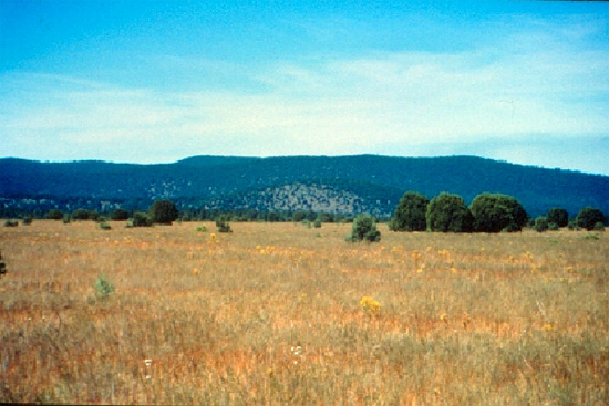
Arizona, New Mexico, 50,200 mi2 (130,000 km2)
Open forest of ponderosa pine in the montane zone, Sitgreaves National Forest, Arizona. Land-surface form.--This area consists mostly of steep foothills and mountains, but includes some deeply dissected high plateaus. Elevations range from 4,500 to 10,000 ft (1,370 to 3,000 m), with some mountain peaks reaching as high as 12,600 ft (3,840 m). In many areas, the relief is higher than 3,000 ft (900 m). Isolated volcanic peaks rise to considerable heights in the northwest.
Open forest of ponderosa pine in the montane zone, Sitgreaves National Forest, Arizona.
Climate
Climate varies considerably with altitude. Average annual temperature is about 55F (13C) in the lower foothills and 40F (4C) on the upper mountain slopes. Average annual precipitation ranges from 10 to 35 in (260 to 890 mm), increasing with rising elevation. During late spring, there is a moisture deficit until the arrival of summer rains, which appear as thunderstorms. Rains also come in early autumn and winter. In the mountains, most precipitation is snow.
Vegetation
Vegetational zones resemble those of the Rocky Mountains (described below), but occur at higher elevations. The foothill zone, which reaches as high as 7,000 ft (2,100 m), is characterized by mixed grasses, chaparral brush, oak-juniper woodland, and pinyon-juniper woodland. At about 7,000 ft (2,100 m), open forests of ponderosa pine are found, although pinyon and juniper occupy southfacing slopes. In Arizona, the pine forests of this zone are strongly infused with Mexican species, including Chihuahuan and Apache pine. Pine forest is replaced at about 8,000 ft (2,400 m) on northfacing slopes (a little higher elsewhere) by Douglas-fir. Aspen is common in this zone, and limber pine grows in places that are rockier and drier.
At about 9,000 ft (2,700 m), the Douglas-fir zone merges into a zone of Engelmann spruce and corkbark fir. Limber pines and bristlecone pines grow in the rockier places. An alpine belt covers relatively small areas above 11,000 ft (3,400 m).
Soils
Detailed information about orders of soils is lacking for much of this area. The Four Corners region is composed mostly of Entisols. Alfisols and Inceptisols dominate upland areas. Stony land and rock outcrops occupy large areas on the mountains and in the foothills.
Fauna
The most common large mammal is the mule deer. Mammalian predators include mountain lions, coyotes, and bobcats. Small mammals are the deer mouse, longtail weasel, porcupine, golden-mantled ground squirrel, Colorado chipmunk, red squirrel, wood rat, pocket gopher, longtail vole, Kaibab (Abert) squirrel, and cottontail.
Some of the more common birds are the northern pygmy-owl, olive warbler, red-faced warbler, hepatic tanager, mountain bluebird, pygmy nuthatch, white-breasted nuthatch, Mexican junco, Steller's jay, red-shafted flicker and the Rocky Mountain sapsucker. Goshawks and red-tailed hawks are present.
The only widely found reptile is the short-horned lizard.
Data Source: United States Department of Agriculture, Forest Service
Province 321, part of the DRY DOMAIN
Chihuahuan Desert
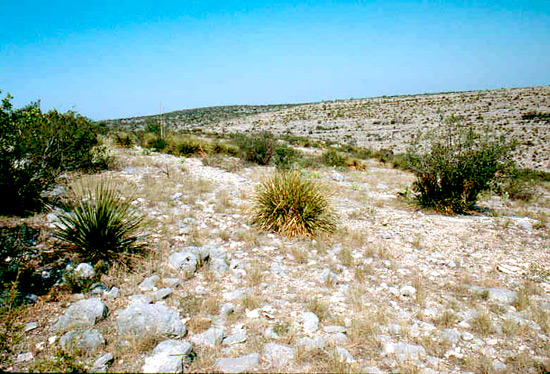
Southeastern Arizona, southern New Mexico, western Texas, 85,200 mi2 (220,700 km2)
Land-Surface Form
This province is mostly desert. Practically the only permanent streams are a few large rivers that originate in humid provinces. The Rio Grande and the Pecos Rivers and a few of their larger tributaries are the only perennial streams. The area has undulating plains with elevations near 4,000 ft (1,200 m), from which somewhat isolated mountains rise 2,000 to 5,000 ft (600 to 1,500 m). Washes, dry most of the year, fill with water following rains. Basins with no outlets drain into shallow playa lakes that dry up during rainless periods. Small whirlwinds constantly play over these dry playas when they are heated by summer sun. Extensive dunes of silica sand cover parts of the province. In a few places there are dunes of gypsum sand, the most notable being the White Sands near Alamogordo in southern New Mexico. In scattered areas, small beds and isolated buttes of blackish lava occur.
Chihuahuan Desert vegetation Chihuahuan Desert vegetation in Big Bend National Park, Texas. The tall plant is yucca. (Photo: National Park Service.)
Climate
Summers are long and hot. Winters are short, but may include brief periods when temperatures fall below freezing. Average annual temperatures range from 50 to 65F (10 to 18C). The climate is distinctly arid; spring and early summer are extremely dry. Mean annual precipitation at El Paso, Texas, is 8.65 in (221 mm). In July, summer rains usually begin, torrential storms that are mostly local and continue through October. The northern part of the province also receives winter rains, which are more gentle and widespread.
Vegetation
A number of shrubs, most of them thorny, are typical of the Chihuahuan Desert. They frequently grow in open stands, but sometimes form low, closed thickets. In many places, they are associated with short grass, such as grama. Extensive arid grasslands cover most of the high plains of the province. On deep soils, honey mesquite is often the dominant plant. Cacti are also abundant, particularly prickly pears, but they are smaller in size and fewer in number of species than in the Sonoran Desert. The desert is characterized by yuccas, so much so that one has been adopted as the state flower of New Mexico. A few cottonwoods and other trees grow beside the widely separated rivers. Creosote bush, which covers great areas in characteristic open stands, is especially common on gravel fans. Though creosote bush is the most abundant plant cover of the province, other species like lechuguilla are also abundant. Another distinctive plant is candelilla, or wax plant. On rocky slopes, the ocotillo is conspicuous. Juniper and pinyons, limited to rocky outcrops, are prominent around the Stockton Plateau in western Texas.
Some isolated mountains in the Chihuahuan Province rise high enough to carry a belt of oak and juniper woodland. On a few of the highest mountains, there are pines among the oaks, in some places forming nearly pure stands. Douglas-fir and white fir occupy a few sheltered upper slopes in the Santa Catalina Mountains.
Soils
In the western and northern portions of this province, the soils are primarily Aridisols. Both Aridisols and Entisols are present in the south.
Fauna
Pronghorn antelope and mule deer are the most widely distributed large game animals. Whitetail deer inhabit parts of Texas. The collared peccary or javelina is common in the southern part of the region. The blacktail jackrabbit, desert cottontail, kangaroo rat, wood rat, and numerous smaller rodents compete with domestic and wild herbivores for available forage. Mammalian predators include the coyote and bobcat.
The black-throated sparrow is one of the most abundant birds of the province. Greater roadrunner, curve-billed thrasher, and Chihuahuan raven are also common. Scaled quail and Gambel's quail occupy most of the area, and bobwhite populations reach into its eastern portion. Raptors include the golden eagle, great horned owl, red-tailed hawk, ferruginous hawk, and the rare zone-tailed hawk.
The many reptiles include the common chuckwalla, Texas horned lizard, desert spiny lizard, and various species of rattlesnakes.
Data Source: United States Department of Agriculture, Forest Service
Province 322, part of the DRY DOMAIN
American Semidesert and Desert
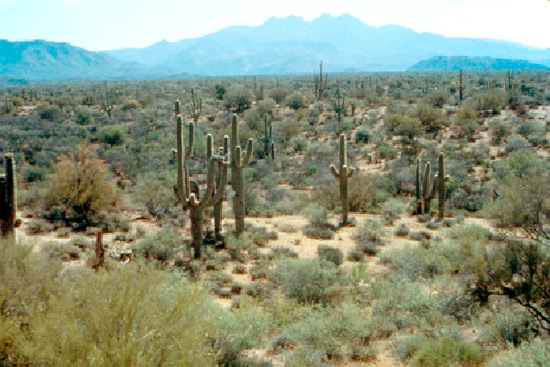
Southeastern California, southwestern Arizona, southern Nevada, 87,700 mi2 (227,100 km2)
Land-Surface Form
The American Desert includes the Mojave, Colorado, and Sonoran Deserts. Its topography is characterized by extensive plains, most gently undulating, from which isolated low mountains and buttes rise abruptly. Elevations range from 280 ft (85 m) below sea level to 4,000 ft (1,200 m) in valleys and basins, with some mountain ranges reaching as high as 11,000 ft (3,400 m). The mountains are rocky and rise abruptly from their outwash aprons and alluvial faces. There are areas of interior drainage, such as the Salton Trough, but a large part of the province drains to the sea through underground seepage or through washes that are dry most of the year. The Colorado River, which crosses the eastern part of the province, is the only sizable stream.
Deeply eroded ranges alternate with smooth basin floors in the Mojave Desert of southern Nevada. Deeply eroded ranges alternate with smooth basin floors in the Mojave Desert of southern Nevada. Note playa in middleground. (Photo: John S. Shelton.)
Climate
Summers are long and hot; the highest temperature ever measured in the United States was 134F (57C) in 1913 at Death Valley. The average annual temperature is 60 to 75F (15 to 24C). Though winters are moderate, the entire province is subject to occasional frosts. In winter the rains are widespread and usually gentle, but in summer they are usually thunderstorms. In the Colorado and Mojave Deserts of southeastern California, there are virtually no summer rains. No part of the province has regular rains, and a year or more may pass without measurable rainfall, especially in the region's western part. Average annual precipitation is 2 to 10 in (50 to 250 mm) in the valleys, but may reach 25 in (610 mm) on mountain slopes. The evaporation rate in summer is very high.
Vegetation
Vegetation is usually very sparse, with bare ground between individual plants. Cacti and thorny shrubs are conspicuous, but many thornless shrubs and herbs are also present. On the Sonoran Desert plains, the most widely distributed plant is the creosote bush, which covers extensive areas in nearly pure stands. On some parts of the plains the arborescent cacti (cholla) are also common. Mesquite is less widespread and grows only along washes and watercourses.
Saguaro cactus and desert shrub Saguaro cactus and desert shrub near the Superstition Mountains of Arizona, American Desert Province (Photo:Soil Conservation Service.)
At the base of the mountains, on the gentle rocky slopes called bajadas, the vegetation is dominated by paloverde, ocotillo, and saguaro, but bitterbrush is also a common shrub. Vegetation below 3,000 ft (900 m) in the Mojave Desert is mostly creosote bush and various Atriplex (saltbush) species. The desert mountains are exceptionally barren, and many are almost devoid of vegetation.
Along the higher northern edge of the province is a belt where the Joshua tree is prominent. At a still higher level is a belt of junipers and pinyons.
Interior basins characterized by ephemeral shallow playa lakes are a conspicuous feature of the Mojave Desert. Soils near these playas contain alkali in quantities varying with distance from the lake, resulting in a zonation of several species of vegetation according to their tolerance for salts.
Soils
Gravel or bare rock covers the ground near the bases of some mountains, and much bare rock is exposed on the mountains because the heavy, violent desert rainstorms allow little soil to accumulate on the steep slopes. Entisols occur on the older alluvial fans and terraces and in the better-drained basins. Aridisols dominate throughout the rest of the province.
Fauna.--Large ungulates are almost absent from the desert. Desert mule deer and peccary live chiefly in the paloverde-cactus shrub community. The Sonoran pronghorn antelope is classified as an endangered species; few are left in southern Arizona. Carnivores, including the desert kit fox and coyote, are small and usually nocturnal. The western spotted skunk is common. Nocturnal burrowers, particularly kangaroo rats and pocket mice, dominate. Merriam kangaroo rat is closely associated with creosote bush. Other important species are the longtail pocket mouse and antelope ground squirrel.
Many desert birds are very selective in their type of habitat. Greasewood may furnish a permanent residence for the loggerhead shrike. Areas where tall cacti are plentiful furnish homes for many birds, including the Gila woodpecker, elf owl, and purple marten. Gambel's quail, the cactus wren, and the roadrunner are common in the southern part of the region. The masked bobwhite quail is an endangered species that has been reintroduced.
Reptiles include numerous species of snakes and lizards, such as the Gila monster, the only poisonous lizard in the United States. The desert tortoise is becoming increasingly rare and is everywhere protected.
Endemic species, common in the Mojave Desert, include five species of desert pupfish living in highly saline lakes in Death Valley.
Data Source: United States Department of Agriculture, Forest Service
Province 331, part of the DRY DOMAIN
Great Plains-Palouse Dry Steppe
Rocky Mountain Piedmont, Upper Missouri Basin Broken Lands, Palouse grassland of Washington and Idaho, 290,700 mi2 (752,900 km2)
Land-Surface Form
This region is characterized by rolling plains and tablelands of moderate relief in a broad belt that slopes gradually eastward from an altitude of 5,500 ft (1,520 m) near the foot of the Rocky Mountains to 2,500 ft (760 m) in the Central States. The plains are notably flat, but there are occasional valleys, canyons, and buttes. In the northern section, badlands and isolated mountains break the continuity of the plains. The Palouse region occupies a series of loess-covered basalt tablelands with moderate to high relief, ranging in altitude from 1,200 to 6,000 ft (370 to 1,800 m).
Shortgrass prairie and badland topography along Little Missouri River, North Dakota. Shortgrass prairie and badland topography along Little Missouri River, North Dakota.
Climate
This region lies in the rain shadow east of the Cascade Range and the Rocky Mountains. The climate of the Great Plains grasslands is a semiarid continental regime. The average annual temperature is 45F (7C) throughout most of the region, but can reach as high as 60F (16C) in the south. Winters are cold and dry, and summers are warm to hot. The frost-free season ranges from fewer than 100 days in the north to more than 200 days in Oklahoma. Precipitation ranges from 10 in (260 mm) in the north to more than 25 in (640 mm) in the south, with maximum rainfall in summer. Evaporation usually exceeds precipitation, and the total supply of moisture is low. When precipitation does occur, it is often in the form of hail or blizzards, and tornadoes and dust storms are frequent.
The climate of the Palouse grassland east of the Cascades is similar to that of the Great Plains grasslands east of the Rockies, except for the timing of precipitation: on the Palouse dry steppe, there is a winter maximum.
Vegetation.--Steppe, sometimes called shortgrass prairie, is a formation class of short grasses usually bunched and sparsely distributed. The steppe in this province is dry, with 6-7 arid months per year. The Great Plains grasslands east of the Rockies have scattered trees and shrubs, such as sagebrush and rabbitbrush, and support all gradations of cover, from semidesert to woodland. Because ground cover is scarce, much soil is exposed.
Many species of grasses and herbs grow in this province. A typical grass is buffalo grass; sunflower and locoweed are typical plants. Other grasses include grama, wheatgrass, and needlegrass. Many wildflower species bloom in spring and summer. The blazingstar and white prickly poppy are usually abundant. The alien Russian-thistle, also know as tumbleweed, is sometimes abundant.
Except for the presence of shrubs, the Palouse grassland resembles the Great Plains shortgrass prairie. The dominant species, however, are distinctive. They include bluebunch wheatgrass, fescue, and bluegrass.
Soil
In this climatic regime, the dominant pedogenic process is calcification; salinization is dominant on poorly drained sites. Soils contain a large excess of precipitated calcium carbonate and are rich in bases. Mollisols are typical. Humus content is small because vegetation is sparse.
Fauna
Large herds of buffalo migrated with the seasons across the steppe plains. Now the pronghorn antelope is probably the most abundant large mammal, but mule deer and whitetail deer are common where brush cover is available along stream courses. The whitetail jackrabbit occupies the northern part of the province, with the blacktail jackrabbit in the area south of Nebraska. The desert cottontail is widespread. The lagomorphs, prairie dogs, and several other small rodents are preyed upon by the coyote and several other mammalian and avian predators; one, the blackfooted ferret, is classified as an endangered species. The thirteen-lined ground squirrel is common here; both prairie dogs and ground squirrels are preyed upon by badgers. The Washington and Columbia ground squirrels inhabit large areas of the Palouse grassland.
The lesser prairie chicken, once abundant, is now classified as threatened. Sage grouse, greater prairie chickens, and sharp-tailed grouse are present in the area. Among the many smaller birds are the horned lark, lark bunting, and western meadowlark. Two bird species are unique to the shortgrass prairies east of the Rockies, the mountain plover and McCown's longspur. Mountain plovers, which resemble killdeer, live in small flocks often seen feeding in freshly plowed fields. Construction of stock ponds has created an important "duck factory" in the northern Great Plains.
Data Source: United States Department of Agriculture, Forest Service
Province 332, part of the DRY DOMAIN
Great Plains Steppe
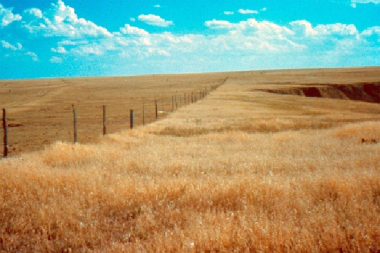
High plains and central lowlands between the prairie parkland and the 104th meridian, from the Canadian border through Oklahoma, 134,000 mi2 (347,100 km2)
Land-surface form.--This region is characterized by flat and rolling plains with relief of less than 300 ft (90 m). Elevations range from 2,500 ft (760 m) near the western edge of the province to 1,000 ft (300 m) at the eastern edge. Except south of the Missouri River, most of the lands are young glacial drifts and dissected till plains. Water covers much of the surface. Loess and sand deposits cover the area south of the Missouri River. This flat-to-rolling hill land has well-developed drainage systems.
Mixed-grass steppe Mixed-grass steppe in the sandhills of central Nebraska.
Climate.--Average annual temperatures in this province range from 40F (4C) in the north to 55F (13C) in the east, 60F (15C) in the west, and 65F (18C) in the south. Along its eastern boundary from Oklahoma to Nebraska, annual precipitation approaches 30 in (770 mm), dropping to about 20 in (510 mm) in North Dakota. Along the western limit of the region, precipitation ranges from 20 in (510 mm) in Oklahoma to 25 in (640 mm) in Nebraska, dropping to 15 in (380 mm) in the extreme northwest. Drought periods are less frequent and severe near the prairie parkland than in the more westerly areas.
Vegetation.--This region, called mixed-grass steppe, reaches from the tallgrass prairie parkland to the shortgrass steppe at about long. 104 W. As its name suggests, it contains a mixture of shortgrass and tallgrass species. The tall grasses grow to a height of about 48 in (1,230 mm); the shorter grasses reach 18 in (460 mm). Shorter dominants include blue grama, hairy grama, and buffalo grass. Taller grasses include little bluestem and needle-and-thread grass. Woody vegetation is rare, except on the cottonwood floodplains.
In mixed-grass steppe, additional species include green needlegrass, sand dropseed, slender wheatgrass, galleta, and purple three-awn. There are numerous species of forbs throughout the region. Match weed or broomweed, scurf-pea, sunflowers, goldenrods, and ragweed occur from Oklahoma into Canada.
The eastern and western boundaries of this region continually shift with changes in precipitation. A series of dry years results in an increased dominance of short grasses (better adapted to a dry climate), moving the region's boundaries to the east. Westward shifts occur after periods of relatively high precipitation, which favor the taller grasses.
Soils.--The soils of the mixed-grass steppe are primarily Mollisols. There are smaller areas of Entisols, such as the sandhills of Nebraska, and one small area of Vertisols. Most soils have dark upper horizons.
Fauna.--Bison once grazed the western margin of the mixed-grass steppe. Pronghorn antelope and coyotes are still present. Jackrabbits are numerous on the steppe, and cottontails are present where there are streams and cover. Burrowing rodents include ground squirrels, prairie dogs, pocket gophers, and many smaller species. Burrowing predators include the badger and the blackfooted ferret, now classified as an endangered species.
The northern portion of this region is an important breeding area for migrating waterfowl. Mourning doves have become abundant in shelterbelt plantings. The sharp-tailed grouse, greater prairie chicken, and bobwhite are present in fair numbers; but the northern greater prairie chicken is classified as threatened.
Data Source: United States Department of Agriculture, Forest Service
Province M331, part of the DRY DOMAIN
Southern Rocky Mountain Steppe--Open Woodland--Coniferous Forest--Alpine Meadow

Middle and southern Rocky Mountains, 102,300 mi2 (265,000 km2)
Land-surface form
The Rocky Mountains are rugged glaciated mountains as high as 14,000 ft (4,300 m). Local relief is between 3,000 ft (900 m) and 7,000 ft (2,100 m). Several sections have intermontane depressions ("parks") with floors less than 6,000 ft (1,800 m) in altitude. Many high-elevation plateaus composed of dissected, horizontally layered rocks lie in Wyoming and Utah.
Spruce-fir forest at the upper timberline of Roaring Fork in the Sawatch Range, Colorado. Spruce-fir forest at the upper timberline of Roaring Fork in the Sawatch Range, Colorado. (Photo: U.S. Geological Survey.)
Climate
The climate is a temperate semiarid steppe regime with average annual temperatures ranging from 35 to 45F (2 to 7C) in most of the region, but reaching 50F (10C) in the lower valleys. Climate is influenced by the prevailing west winds and the general north-south orientation of the mountain ranges. East slopes are much drier than west slopes; individual mountain ranges have similar east-west slope differences regionwide. Winter precipitation varies considerably with altitude (see Appendix 2, climate diagram for Pikes Peak, Colorado). Total precipitation is moderate, but greater than on the plains to the east and west. In the highest mountains, a considerable part of annual precipitation is snow, although permanent snowfields and glaciers cover only relatively small areas. Bases of these mountains receive only 10 to 20 in (260 to 510 mm) of rainfall per year. At higher elevations, annual precipitation increases to 40 in (1,020 mm), and average temperatures fall.
Vegetation
A striking feature of the region is its pronounced vegetational zonation, controlled by a combination of altitude, latitude, direction of prevailing winds, and slope exposure. Generally, the various zones are at higher altitudes in the southern part of the province than in the northern, and they extend downward on eastfacing and northfacing slopes and in narrow ravines and valleys subject to cold air drainage. The uppermost (alpine) zone is characterized by alpine tundra and the absence of trees. Directly below it is the subalpine zone, dominated in most places by Engelmann spruce and subalpine fir. Below this area lies the montane zone, characterized by ponderosa pine and Douglas-fir, which frequently alternate--ponderosa pine dominates on lower, drier, more exposed slopes, and Douglas-fir is predominant in higher, moister, more sheltered areas.
After fire in the subalpine zone and in the upper part of the montane zone, the original forest trees are usually replaced by aspen or lodgepole pine.
Grass, often mixed with sagebrush, regularly covers the ground in open ponderosa pine forests and some treeless areas. These treeless openings are usually small, and they often alternate (depending on slope exposure) with ponderosa pine forest. At the lower edge of the montane zone, they may open onto the adjacent grass and sagebrush belt.
Below the montane belt is the foothill (woodland) zone. Dry rocky slopes in this zone often have a growth of shrubs in which mountain-mahogany and several kinds of scrub oak are conspicuous. Along the border of the Colorado Plateau Province, ponderosa pine and pinyon-juniper associations frequently alternate, depending on slope exposure.
Unforested parks are a conspicuous feature of this province. Many are dominated by grasses, but some are covered largely by sagebrush and other shrubs, such as antelope bitterbrush.
Soils.--In the Rocky Mountains, soil orders occur in zones corresponding to vegetation, ranging from Mollisols and Alfisols in the montane zone to Aridisols in the foothill zone. In addition, because of steep slopes and recent glaciation, there are areas of Inceptisols.
Fauna.--Common large mammals include elk, deer, bighorn sheep, mountain lion, bobcat, beaver, porcupine, and black bear. Grizzly bear and moose inhabit the province's northern portions. Small mammals include mice, squirrels, martens, chipmunks, mountain cottontails, and bushytail woodrats.
Common birds include the mountain bluebird, chestnut-backed chickadee, red-breasted nuthatch, ruby-crowned kinglet, pygmy nuthatch, gray jay, Steller's jay, and Clark's nutcracker. Rosy finches are found in the high snowfields. Blue and ruffed grouse are the most common upland game birds. Hawks and owls inhabit most of the region.
Data Source: United States Department of Agriculture, Forest Service
Province M332, part of the DRY DOMAIN
Middle Rocky Mountain Steppe--Coniferous Forest--Alpine Meadow
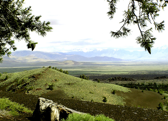
Blue Mountains, Salmon River Mountains, basins and ranges of southwestern Montana, 81,800 mi2 (211,900 km2)
Land-Surface Form
Most of central Idaho and the Salmon River Mountains are formed by granitic intrusions that collectively make up the Idaho Batholith, with altitudes ranging from 3,000 to 7,000 ft (900 to 2,130 m). The batholith is deeply dissected, with a relief greater than 3,000 ft, and its granite is heavily weathered over large areas. East of the batholith is a basin-and-range area consisting of mountains, alluvial fans at their bases, and floodplains along the streams draining the valleys. To the west lie the Blue Mountains, which seldom exceed 8,000 ft (2,400 m) but have at least one peak 10,000 ft (3,050 m) high. The Snake River crosses the province at the bottom of Hells Canyon, which is deeper than the Grand Canyon. Many of the region's higher reaches have been glaciated.
Altitudinal zonation in the Sawtooth Mountains of Idaho, with semidesert shrubs in the foreground, coniferous forests on the lower mountain slopes, and alpine tundra toward the top. Altitudinal zonation in the Sawtooth Mountains of Idaho, with semidesert shrubs in the foreground, coniferous forests on the lower mountain slopes, and alpine tundra toward the top.
Climate
Despite the northerly latitudes and high altitudes of this region, its climates are surprisingly mild due to their proximity to the Pacific Ocean. Mean monthly temperatures at Canyon City, Oregon (near John Day), range from just above freezing to 68F (20C). In the mountain valleys of Montana, January temperatures average as much as 10F (6C) higher and summer temperatures 5 to 10F (3 to 6C) lower than on the Great Plains just to the east. The average length of the growing season is about the same as on the Great Plains, roughly 120 days. Temperature and snowfall, of course, vary greatly with altitude. Winds are from the west, with much of their moisture precipitated where they cross the Pacific ranges. Consequently, most of this portion of the Rocky Mountains is semiarid. Valleys get less than 20 in (510 mm) of precipitation each year; up to 30 in (770 mm) falls in the mountains, mostly as snow.
Vegetation
Altitudinal zones are evident. Below the subalpine zone, Douglas-fir is the climax dominant, with grand fir as an associate west of the continental divide, chiefly on westfacing slopes. Lodgepole pines and grasses grow principally in the basins and ranges in the eastern and southeastern part of the province. Below the Douglas-fir belt, ponderosa pine is dominant to the west of the continental divide, constituting a xerophytic forest. The lower slopes of the mountains and the basal plain are dominated by sagebrush semidesert or steppe.
Due to aridity, forests directly east of the Bitterroot Mountains are usually restricted to northern and eastern slopes. Although south- and westfacing slopes receive comparable precipitation, they are hotter and evaporation is higher. Consequently, they support few trees and are covered by shrubs and grasses.
Soils
Soils of the fans and valley floors, most of which lie below 2,000 ft (600 m), are Mollisols. These soils support sagebrush and grass. Above 2,000 ft, under coniferous forest, the soils are Alfisols. Areas recently glaciated or with steep slopes have Inceptisols.
Fauna
Fauna in the Middle Rocky Mountain Province are like those elsewhere in the Rockies to the north and south. However, parts of the province are filled with mountain ranges that are isolated by stretches of arid territory. Each such range usually contains a group of species peculiar to the region, and some of these species may be found only in a single range.
Data Source: United States Department of Agriculture, Forest Service
Province M333, part of the DRY DOMAIN
Northern Rocky Mountain Forest-Steppe--Coniferous Forest--Alpine Meadow

Northern Idaho, western Montana, eastern Washington, 38,100 mi2 (98,700 km2)
Land-surface form
The Northern Rocky Mountain Province consists of high, rugged mountains rising to more than 9,000 ft (2,700 m), with a local relief in excess of 3,000 ft (900 m). Most of the region has been glaciated. In the several Rocky Mountain trenches, there are flat or nearly flat valleys, some of which are several miles wide.
A stand of giant western redcedar in the Northern Rocky Mountain Province, Kootenai National Forest, Montana. A stand of giant western redcedar in the Northern Rocky Mountain Province, Kootenai National Forest, Montana.
Climate
Severe winters are usual. The average temperature of the coldest month is below 32F (0C), and the average temperature of the warmest month is below 72F (22C). Summer days are often hot and nights cool. Precipitation averages 20 to 40 in (510 to 1,020 mm) per year and is concentrated in fall, winter, and spring. Summers are usually dry, because westerly air masses draw the dry climate of the Pacific coast across the area. As a result, there is a distinct climatic gradient from north to south and east to west. Snowfall in winter is heavy, but permanent snowfields and glaciers cover only rather small areas.
Vegetation
Mixed evergreen-deciduous forest predominates; Douglas-fir forest and cedar-hemlock-Douglas-fir forest are the two major types.
Well-marked life belts are a striking feature of the province. In the uppermost (alpine) belt, trees are absent. The subalpine belt is dominated in most places by Engelmann spruce and subalpine fir. In the Bitterroot Range, mountain hemlock is said to be the climax tree of the subalpine belt. Western redcedar and western hemlock are characteristic of the montane belt. Associated trees include Douglas-fir (found throughout the region), along with western white pine, western larch, grand fir, and western ponderosa pine (found in the south). In these forests, areas that have been burned or cut are invaded first by larch, a deciduous conifer. White pine may crowd out the larch, then be replaced by hemlock, redcedar, and lowland white fir. Depending on latitude, the lower part of the montane belt may be interspersed with grass and sagebrush.
Soils
Soils are mostly cool, moist Inceptisols. A variety of igneous, sedimentary, and metamorphic rocks form the mountain masses. But compared to other parts of the Rocky Mountains, the shallowness and stoniness of soils play a relatively minor role in forest distribution. In the foothills of the Rockies and to the south of the glacial border, the loess and volcanic ash deposited on the slopes have helped to form excellent soils.
Fauna
Large mammals in this province include black bear, deer, elk, mountain goat, mountain lion, and bobcat. Smaller mammals include Columbia ground squirrel, flying squirrel, marten, redtail chipmunk, and bushytail woodrat.
Some familiar birds are hawks, jays, chestnut-backed chickadees, red-breasted nuthatches, and great gray owls. Blue and ruffed grouse are the most common game birds.
Data Source: United States Department of Agriculture, Forest Service
Province M334, Part of the DRY DOMAIN
Black Hills Coniferous Forest
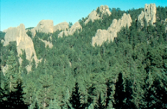
Black Hills, 3,700 mi2 (9,600 km2)
Land-surface form
The Black Hills are a maturely dissected domal uplift with an exposed core of Precambrian rocks; encircling hogbacks, enclosed hogbacks, and enclosed strike valleys rim the province. The Black Hills are actually a low mountain with a relief of 1,000-5,000 ft (300-1500 m). The plains surrounding the Black Hills have altitudes of 3,000-3,500 ft (900-1,100 m), compared to an altitude of 7,242 ft (2,207 m) for Harney Peak, the highest peak in the Black Hills. Most of the peaks in the central area of the Black Hills have altitudes between 5,000 and 6,600 ft (1,520 and 2,010 m).
Climate
The climate is temperate steppe. Winters are cold, with temperatures below freezing. The average annual temperature ranges from 48F (9C) at lower elevations to 37F (3C) at higher ones. The frost-free season varies from 80 to 140 days, depending on altitude. Annual precipitation, which ranges from 15 to 26 in (380 to 660 mm), falls mostly as winter snow, despite a spring maximum.
Vegetation
Because there is more precipitation than in the surrounding semiarid plains, the Black Hills support an evergreen forest made up of eastern, western, and northern forest species. Because elevations barely exceed 7,000 ft (2,100 m), there are no significant alpine or subalpine zones. White spruce, extending southward from Canada, is the only dominant on higher slopes in the montane zone; there is no Douglas-fir. Paper birch from the northern conifer forest is also present. Aspen covers considerable areas, presumably indicating fires in the past. Ponderosa pine dominates most lower slopes in the montane zone, with lodgepole pine from the Rockies found in small numbers. Along streams and rivers, eastern broadleaf species are common, including ash, hackberry, elm, birch, and bur oak.
Intervening valleys form open parks. Shrubs such as sagebrush are common. At the lower edge of the montane zone, ponderosa pine grows in scattered open stands and savannas. Encroaching on the grasslands, it is periodically burned back.
Soils
Most of the soils are Alfisols.
Fauna
Large mammals such as elk, mule deer, and whitetail deer are common. Small herds of bison and pronghorn antelope populate the grasslands, along with colonies of blacktail prairie dogs. Red squirrels abound, and Harney Peak is inhabited by mountain goats recently introduced into the region.
Many bird species occur throughout the Black Hills, some typically western, some more eastern in range, including the blue jay, dark-eyed junco, and gray jay.
Amphibians include the Great Plains toad.
Data Source: United States Department of Agriculture, Forest Service
Province 341, part of the DRY DOMAIN
Intermountain Semidesert and Desert
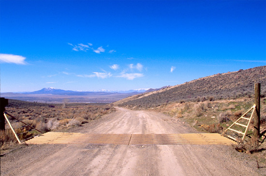
Nevada, Utah, 107,100 mi2 (277,400 km2)
Land-Surface Form
The Intermountain Desert Province covers the physiographic section called the Great Basin and the northern Colorado Plateau in Utah. Much of this area is made up of separate interior basins; only a small part of it drains to the sea. The lower parts of many basins have heavy accumulations of alkaline and saline salts. Streams are rare and few are permanent. Many mountains rise steeply from the semiarid, sagebrush-covered plains. These mountains are generally well covered by vegetation, and their upper elevations usually bear sparse conifer forests.
Temperate semidesert in Utah. Temperate semidesert in Utah. Shadscale is the principal shrub shown.
Climate
Summers are hot, but winters are only moderately cold. The average annual temperature ranges from 40 to 55F (4 to 13C). Spring comes early, except at higher elevations. Annual precipitation averages only 5 to 20 in (130 to 490 mm), often falling as winter snow. Almost no rain falls during the summer months except in the mountains.
Vegetation
Sagebrush dominates at lower elevations. Other important plants in the sagebrush belt are antelope bitterbrush, shadscale, fourwing saltbush, rubber rabbitbrush, spiny hopsage, horsebrush, and short-statured Gambel oak. All these shrubs tolerate alkali to varying degrees, essential to their survival on the poorly drained soils widespread in the region. On soils with the highest concentrations of salt, even these shrubs are unable to grow; they are replaced by plant communities dominated by greasewood or saltgrass.
Although sagebrush now dominates this zone, it may not represent climax growth, but rather a disclimax produced by overgrazing. In plots protected from fire, grasses typical of the Palouse grassland or mixed-grass steppe gradually become dominant.
Above the sagebrush belt lies a woodland zone dominated by pinyon pine and juniper, similar to the pinyon-juniper woodland of the Colorado Plateau.
Pinyon-juniper woodland Pinyon-juniper woodland in Emery County, Utah.
In the montane belt above the woodland zone, ponderosa pine generally occupies the lower and more exposed slopes and Douglas-fir the higher and more sheltered ones. In the subalpine belt, the characteristic trees are subalpine fir and Engelmann spruce. Only a few mountains rise high enough to support an alpine belt.
Soils
Aridisols dominate all basin and lowland areas; forest soils are found at higher elevations. Narrow bands of Entisols lie in stream floodplains and rocky landscapes. Salt flats and playas without soils are extensive in the lower parts of basins with interior drainage.
Fauna
Few large mammals live in this province, but mule deer, mountain lion, bobcat, and badger occasionally venture into it. Sagebrush provides ideal habitat for pronghorn antelope and whitetail prairie dog. The most common species are such small mammals as ground squirrels, jackrabbits, kangaroo mice, wood rats, and kit foxes. In the lower life belts, some ground squirrels--especially the Belding and Townsend ground squirrels--become dormant during the hot, dry summer.
Bird species range from the burrowing owl to such specialized species as sage sparrow and sage thrasher, both found only in sagebrush habitat. Raptors include the American kestrel and golden eagle, along with the ferruginous hawk and various other species of western hawks. In early spring, groups of sage grouse engage in elaborate courtship displays.
Data Source: United States Department of Agriculture, Forest Service
Province 342, part of the DRY DOMAIN
Intermountain Semidesert
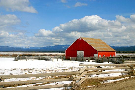
Columbia-Snake River Plateaus, Wyoming Basin, 159,100 mi2 (412,100 km2)
Land-surface form
This province covers the plains and tablelands of the Columbia-Snake River Plateaus and Wyoming Basin. The plateaus include most of the Northwest's lava fields. Lying at about 3,000 ft (900 m), the plateaus are surrounded by lavas that have been folded or faulted into ridges. To the south, the plateaus grade into the basins and ranges of the Intermountain Desert Province. The Wyoming Basin consists of plains at elevations of 6,000-8,000 ft (1,800-2,400 m) broken by isolated hills and low mountains 1,000-2,000 ft (300-600 m) higher. In the south, broad intermountain basins and isolated small mountain ranges merge into a dissected plateau. Sloping alluvial fans at the edges of the basins merge into flat plains in the center. Badlands are typical of the dissected areas along the region's outer edges.
Sagebrush basal plain Sagebrush basal plain near Big Butte, Idaho.
Climate
The climate of the plateaus is semiarid and cool, with an average annual temperature of about 50F (10C). Average annual precipitation ranges from less than 10 in (260 mm) in the west (in the rain shadow of the Cascade Range) to 20 in (510 mm) in the east. Precipitation is fairly evenly distributed throughout the year, except during the summer months, when there is little rain.
The higher overall elevation of the Wyoming Basin gives it slightly lower average temperatures and precipitation than on the plateaus. Winters are cold, and summers are short and hot. Average annual temperatures range from 40 to 52F (4 to 11C), and the average growing season has fewer than 100 days in the south and 140 days in the north and east. Average annual precipitation ranges from 5 to 14 in (130 to 360 mm), and is fairly evenly distributed throughout the year.
Vegetation
The chief vegetation, sometimes called sagebrush steppe, is made up of sagebrush or shadscale mixed with short grasses. Moist alkaline flats support alkali-tolerant greasewood. Along streams in and near the mountains where the water is good, valley bottoms are lined with willows and sedges, which give way to greasewood and other alkali-tolerant plants as one moves away from the mountains. Lands in the Columbia River Basin with more than 10 in (260 mm) of rainfall per year have an open cover of bunchgrass, and are excellent for raising wheat. A woodland of western juniper covers parts of central Oregon that get little rain.
Soils
This province has extensive alluvial deposits in the floodplains of streams and in the fans at the foot of mountains. Dry lake beds are numerous, and there are extensive eolian deposits, including both dune sand and loess. In the Columbia River Basin, loess deposits are up to 150 ft (46 m) thick, and soils developed from them are correspondingly complex. Aridisols dominate all basin and lowland areas; Mollisols are found at higher elevations.
Soils in the Wyoming Basin are alkaline Aridisols. Subsoils contain a layer enriched with lime and/or gypsum, which may develop into a caliche hardpan. Because the basin is semiarid and weathering is therefore slight, soil texture and composition are governed by parent materials. Entisols are found in the Bighorn basin.
Fauna
Because of its wilderness character, this region supports a great variety of wildlife species. In winter, seasonal changes force many birds and mammals to move from the mountains into the sagebrush semidesert, where they find suitable habitat alongside the area's permanent residents.
Major mammals are coyote, pronghorn antelope, mountain lion, and bobcat. Smaller species include Wyoming ground squirrel, whitetail prairie dog, deer mouse, whitetail jackrabbit, and porcupine. During severe winters, elk and mule deer move into the desert. Moose are locally important in the dense willow thickets along the desert watercourses of eastern Idaho and western Wyoming.
This region is an important breeding and resting ground for migrating waterfowl. Mallards, pintails, green-winged teal, and gadwalls are most common. Canada geese are locally important. Sage grouse are the most abundant upland game bird. The numerous raptors here include Swainson's hawk, ferruginous hawk, rough-legged hawk, red-tailed hawk, marsh hawk, prairie falcon, great horned owl, and burrowing owl.
Reptiles include sagebrush lizard, horned lizard, and prairie rattlesnake.
Data Source: United States Department of Agriculture, Forest Service
Province M341, part of the DRY DOMAIN
Nevada-Utah Mountains Semidesert--Coniferous Forest--Alpine Meadow
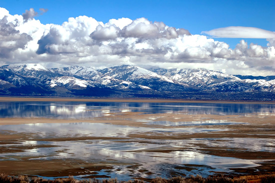
Central Great Basin, Utah high plateaus, Tavaputs Plateau of the Colorado Plateau, 43,600 mi2 (112,900 km2,)
Bristlecone pine at timberline in Great Basin National Park, Nevada.
Land-Surface Form
This province covers the highest areas of the Great Basin and Colorado Plateau, including valleys that are 5,000 ft (1,500 m) in elevation. Although some valleys are closed, none contain perennial lakes. Streams are rare and few are permanent. Many linear mountain ranges rise steeply from the semiarid plains, reaching altitudes up to 13,000 ft (3,960 m). They are composed mostly of folded and faulted sedimentary rocks block faulted to produce basins and ranges. To the east, on the Colorado Plateau, the mountains are formed from high-elevation plateaus composed of dissected, horizontally layered rocks.
Bristlecone pine at timberline in Great Basin National Park, Nevada. (Photo: National Park Service.)
Climate
This region has a high-altitude variation of the temperate desert climate, with a very pronounced drought season and a short humid season. Most precipitation falls in winter, despite a peak in August (see Appendix 2, climate diagram for Panguitch, Utah). Winters are long, and climate varies considerably with altitude. Average annual temperatures range from about 38F (3C) 50F (10C) in the valleys to 50F (10C) 38F (3C) on upper mountain slopes. Average annual precipitation ranges from 5 to 8 in (130 to 200 mm) in the valleys to 25 to 35 in (640 to 890 mm) at higher elevations. A considerable portion of winter precipitation is snow, and summer afternoon thunderstorms are common on the Colorado Plateau.
Vegetation
Sagebrush dominates at lower elevations. Other important plants in the sagebrush belt are shadscale, fourwing saltbush, rubber rabbitbrush, spiny hopsage, and horsebrush. All tolerate alkali to varying degrees, essential to their survival on the poorly drained soils widespread in the region. Where salt concentrations are very high, even these shrubs are unable to grow; they are replaced by plant communities dominated by greasewood or saltgrass.
The woodland belt above the sagebrush zone is similar to the corresponding belt on the Colorado Plateau, with juniper and pinyon occupying lower mountain slopes. The belt is frequently interrupted as mountains give way to plains.
In the montane zone above the woodland belt, ponderosa pine generally occupies the lower and more exposed slopes and Douglas-fir the higher and more sheltered ones. Typical species of the subalpine belt are alpine fir and Engelmann spruce. Great Basin bristlecone pine, with some individuals more than 1,000 years old, occupies widely scattered peaks. Only a few mountains in this province rise high enough to support an alpine meadow belt.
Soils
Aridisols dominate all basin and lowland areas; Mollisols and Alfisols are found at higher elevations in the mountains. Salt flats and playas without soil are extensive in the Great Basin.
Fauna.--Sagebrush shrublands provide ideal habitat for pronghorn antelope and whitetail prairie dog. Golden-mantled squirrels inhabit the region's ponderosa pine forests, and snowshoe hares along with red squirrels are found throughout the spruce-fir forests of Utah.
The sagebrush shrublands contain many species of birds, ranging from burrowing owls to such specialized species as sage sparrow and sage thrasher, both found in no other type of habitat. Various raptors prey on jackrabbits, including the American kestrel, ferruginous hawk, and golden eagle. The pinyon jay is typical of the pinyon-juniper forest, which also supports the plain titmouse and black-throated gray warbler, along with flocks of bushtits. Ponderosa pine forests contain the Steller's jay and dark-eyed junco.
Many reptiles can be found; collared lizards are common.
Data Source: United States Department of Agriculture, Forest Service
Province 411, Part of the HUMID TROPICAL DOMAIN
Everglades
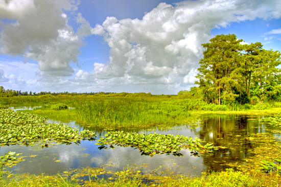
Southern Florida, Florida Keys, 7,800 mi2 (20,200 km2)
Land-surface form.--The Everglades occupy an extensive, almost flat marl and limestone shelf generally covered with a few feet of muck and a little sand. Elevation ranges from sea level to 25 ft (7.6 m). The low, level coastal plain contains large areas of swamps and marshes, with low beach ridges and dunes rising several feet above them. Poorly defined broad streams, canals, and ditches drain into the ocean. In the interior, hammocks rise a few feet above the general area.
The flat, marshy surface of the Florida Everglades. The flat, marshy surface of the Florida Everglades. (Photo: National Park Service.)
Climate
Average annual temperatures in this tropical climate range from 70 to 75F (21 to 24C), with minimums from October to February. The area is frost-free practically all year. An average of 50 to 65 in (1,280 to 1,660 mm) of rain falls per year, mostly between late spring and the middle of autumn.
Vegetation
About one-fifth of the area is covered by tropical moist hardwood forest. Cypress forests are most extensive, but mangrove is widespread along the eastern and southern coasts. Much of the area is open marsh covered by phreatophytic grasses, reeds, sedges, and other aquatic herbaceous plants. Several areas covered by dense grasses are classified as medium-tall grasslands, with sawgrass and three-awns as major plants. Within these grasslands there are mesic habitats called "hammocks" that rise above the surrounding, usually wetter areas. These hammocks contain groves of low to medium-tall broadleaf evergreen trees and shrubs. Mahogany, redbay, and several palmettos are common. One also finds strangler fig and abundant epiphytes.
Soils
Histosols are the principal soils. In slightly less wet parts of the southern Everglades, Inceptisols occupy extensive areas.
Fauna
The Everglades have a wide variety of influent species from adjacent areas of palmetto prairie, cypress swamp, magnolia forest, and mangrove. Slight changes in water level create substantial changes in habitat and fauna.
Among the many mammals found are whitetail deer, Florida panther, black bear, raccoon, bobcat, opossum, skunk, various bats, marsh and swamp rabbits, cotton rat, and fox squirrel. Manatees inhabit estuaries and interlacing channels.
Numerous species of birds live in this province. Before the water level in much of the Everglades was lowered by drainage, the area was home to large numbers of herons, egrets, limpkins, mottled ducks, Florida Everglade kites (snail kites), and other birds. The Florida Everglade kite is now classified as endangered.
Characteristic lizards are the Caroline anole and the brown red-tailed skink. The rough green snake, key rat snake, and southern Florida coral snake are found here. The endangered American alligator is a year-round resident.
Data Source: United States Department of Agriculture, Forest Service
Province 124, part of the polar domain
Arctic Tundra
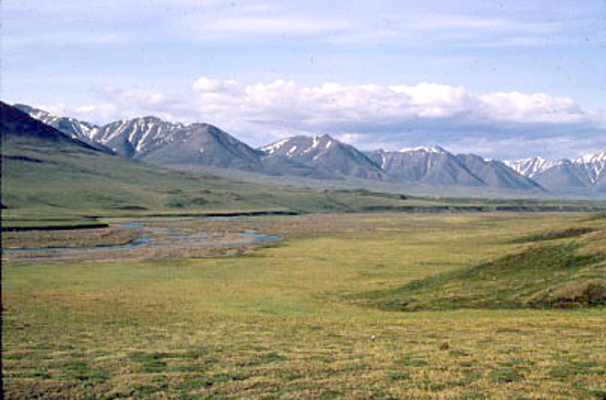
Northern arctic coastal plain, 19,100 mi2 (49,500 km2)
Land-surface form--The north coast of Alaska is a broad, level plain that is generally less than 1,000 ft (300 m) in elevation. Rolling foothills rise near the Colville River and gain altitude southward into the Brooks Range. In summer, thousands of lakes and marshes dot the plain.
Watersedge tundra of the Arctic Tundra Province on the arctic coastal plain of Alaska Watersedge tundra of the Arctic Tundra Province on the arctic coastal plain of Alaska. (Photo: U.S. Fish and Wildlife Service)
Climate
The severe arctic climate reaches temperatures of -60F (-51C) in winter. Average annual temperature is only 10 to 20F (-12C to -6C). Due to its location in the extreme north, this province gets very different amounts of sunlight at different times of year. In summer, the sun remains above the horizon 24 hours a day for from 2 to 85 consecutive days, depending on the latitude; in winter, it can remain below the horizon 24 hours a day for as long as 67 consecutive days. All sunlight is received at oblique angles that average 41 degrees. The growing season averages only 2 weeks per year. Precipitation is very low throughout the year; average annual precipitation is only 7 in (180 mm).
Vegetation--Permafrost limits the rooting depth of plants and forces surface water to drain by preventing it from seeping into the soil. Extensive marshes and lakes result. Cottongrass-tussock, the most widespread vegetation system in the Arctic, is associated with sedges, dwarf shrubs, lichens, mosses, dwarf birch, Labrador-tea, and cinquefoil. These highly productive systems produce 500-1,000 lb (227-454 kg) of vegetation per acre, an important source of food for caribou and waterfowl. Several forbs flower brightly in the short summer.
Soils
The soils are wet, cold Inceptisols with weakly differentiated horizons. Soils on south slopes and low moraines are well drained and loamy, with permafrost and ice features. They are underlain by coarse outwash and till. The uplands have localized areas of poorly drained clayey soils; lowland soils are deep, wet, and silty. There is no surface water in winter and only moderate flows in summer. Supplies of ground water are very limited. The entire province is under continuous permafrost to depths of 2,000 ft (600 m) in some areas.
Fauna
Mammals of the Arctic include brown bear, wolf, wolverine, caribou, arctic hare, mink, weasel, and lemming. Polar bear, walrus, and arctic fox are common on the ice pack and coastal areas during winter.
Shore and lake areas provide rich habitat for millions of migrating waterfowl and shore birds during the summer months. Ptarmigans, ravens, hawks, and open country owls are common. Gyrfalcons have also been seen on sea ice.
Data Source: United States Department of Agriculture, Forest Service
Province 125, part of the polar domain
Bering Tundra (Northern)
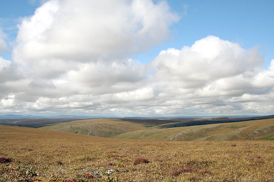
Seward Peninsula, Yukon-Kuskokwim coastal lowland, 46,900 mi2 (121,500 km2)
Land
surface form.--The Bering Tundra is a western extension of the arctic coastal plain, a broad lowland area rising gradually to the east. General topography is less than 1,000 ft (300 m) in elevation, broken in places by small mountain groups that rise 2,500-3,500 ft (800-1,100 m). Standing water is present in thousands of shallow lakes and marshes along the coast. Two large braided rivers, the lower Yukon and the Kuskokwim, flow out of the province to the southwest.
Climate
The climate is less severe in the Bering Tundra than on the arctic slope, but it also has cold winters and generally cool summers. Temperatures range from a high of 90F (32C) in summer to a low of -70F (-57C) in winter. Annual precipitation averages 17 in (430 mm).
Vegetation
Vegetation along the wet coastal areas is chiefly sedge and cottongrass; woody plants grow on higher sites. Birch-willow-alder thickets are extensive in transition zones between beach and forest. The lower Yukon and Kuskokwim Valleys are dominated by white spruce mixed with cottonwood and balsam poplar in tall, relatively dense stands, with a dense undergrowth of thinleaf alder, willow, rose, dogwood, and various species of berry bushes.
Soils
Coastal soils are wet, cool Inceptisols over silt, sand, and marine sediments. The lower Yukon and Kuskokwim Valley bottoms have pockets of Entisols with no soil horizons. Ground water throughout the area is limited, but some is present in the major river valleys. Surface water on the Seward Peninsula ceases to flow in winter, but further south it flows year-round. Permafrost is continuous under most of the area.
Fauna
River bottom lands provide excellent habitat for furbearers, game birds, and moose. Upland and coastal areas support brown and black bear, wolf, wolverine, coyote, caribou, reindeer, snowshoe hare, red fox, lynx, beaver, moose, squirrels, mice, weasel, mink, and marten. Along the northern Bering Sea coast, polar bear, walrus, and arctic fox are occasionally found.
Coastal areas provide extensive and excellent habitat for migrating waterfowl and shore birds. Other bird species in the area include ospreys, falcons, grouse, ravens, golden eagles, and various hawks and owls.
Data Source: United States Department of Agriculture, Forest Service
Province 126, part of the polar domain
Bering Tundra (Southern)
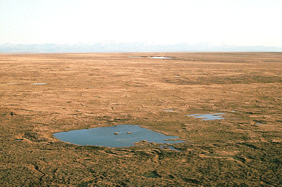
Nushagak-Bristol Bay lowland, 23,600 mi2 (61,100 km2)
Bering Tundra landscape Land-surface form
This province is a moraine- and outwash-mantled lowland that rises from sea level to an altitude of 300-500 ft (90-150 m), with a local relief of 50-250 ft (15-80 m). Drained by the Nushagak and other large rivers that flow into Bristol Bay, the lowland is dotted with morainal and thaw lakes.
Bering Tundra landscape of the Bristol Bay lowlands. (Photo: National Park Service.)
Climate
This province has a marine phase of the tundra climate, with cold winters and cool, short summers. In the Koppen-Trewartha system, the marine tundra climate is not designated separately, but rather classified under tundra (Ft). But annual temperature ranges are much smaller in the marine phase than elsewhere in the tundra climate, winters are much milder, and annual precipitation is far greater (see Shear (1964) for further discussion). Daily winter lows average 5F (-15C) in the Nushaguk lowlands and 14F (-10C) along the Alaska Peninsula, and winter highs average around freezing throughout the region. Daily summer lows average just above freezing, with summer highs averaging around 64F (18C). Average annual precipitation is 13 to 34 in (330 to 870 mm).
Vegetation
Moist and wet tundra communities provide the dominant vegetation. Standing water, mosses, sedges, and low-growing shrubs cover most of the area. Alder, willows, and scattered stands of stunted spruce and birch grow along the major rivers and streams.
Soil
Dominant soils are Inceptisols. Most soils are formed in ash deposits of various thickness, underlain by gravelly glacial till, outwash deposits, or silty alluvium. Coastal plain soils are formed in gravelly alluvium, cinders, or weathered rock blanketed by thick sedge peat. Permafrost is sporadic or absent.
Fauna
Brown bears are common mammals, partly because of large salmon runs in this area.
Bristol Bay provides staging and migration habitat for large numbers of waterfowl. Ospreys occur more frequently in this province than in any other part of Alaska. Blackpoll warblers are common breeders in conifer stands in the north.
Bristol Bay supports the largest run of sockeye salmon in the world.
Data Source: United States Department of Agriculture, Forest Service
Province M121, part of the polar domain
Brooks Range Tundra--Polar Desert
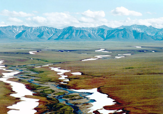
Northern Alaska, 101,600 mi2 (263,100 km2)
Land-surface form
The Brooks Range, a northern extension of the Rocky Mountains, reaches 600 mi (970 km) westward from Canada to the Chukchi Sea. Its rugged peaks reach elevations of 9,000 ft (2,700 m) in the east, falling to 3,000 ft (900 m) in the west. Broad U-shaped valleys, morainal topography, and braided stream channels show evidence of glaciation. A series of rolling plateaus and low mountains, the arctic foothills, borders the coastal plain to the north.
Caribou from the Porcupine herd grazing along the braided channel of Joe Creek in the eastern Brooks Range, Alaska. Caribou from the Porcupine herd grazing along the braided channel of Joe Creek in the eastern Brooks Range, Alaska. Caribou are a major arctic herbivore. (Photo: U.S. Fish and Wildlife Service.)
Climate.
The climate of the Brooks Range is similar to that of the arctic coastal plain, but precipitation increases at the higher altitudes and at the east end of the range. Summer temperatures reach 90 to 100F (32 to 38C), and winter temperatures drop as low as -75F (-60C). Because the province lies above the Arctic Circle, it gets several days of 24-hr sunlight in June, and several sunless days in December. Precipitation averages 7 to 15 in (180 to 390 mm), but drainage is rapid due to the area's steep slopes and the low holding capacity of its soils.
Vegetation
In the higher alpine areas, plant cover is discontinuous over barren rock. It consists chiefly of low mats of such herbaceous and shrubby species as dwarf arctic birch, crowberry, Labrador-tea, arctic willow, resin birch, and dwarf blueberry. Areas at lower elevations may be covered by a mat of sedge and shrub that provides valuable forage for caribou. Cottongrass, bluejoint, mosses, dwarf willow, dwarf birch, Labrador-tea, and bistort are common. Regeneration is extremely slow for most species; some mosses require more than 60 years to recover from disturbance.
Soils
The mountains are underlain by folded and faulted limestone, the foothills by various sediments. Soils are rocky and poorly developed. Inceptisols cover the lower slopes. Glacial and alluvial deposits occur in the valleys and at the base of the mountain slopes. Permafrost is continuous under the entire area.
Fauna
The Brooks Range is an important big-game area in Alaska, supporting brown and black bear, wolf, wolverine, caribou, and Dall sheep. Smaller mammals include marmot, red and arctic fox, ground squirrel, lemming, and pika.
The Brooks Range is an important resting area for migrating waterfowl and songbirds during summer. Raptors prominent in many areas include golden eagles, marsh hawks, gyrfalcons, and snowy and other open country owls.
Data Source: United States Department of Agriculture, Forest Service
Province M125, part of the polar domain
Seward Peninsula Tundra--Meadow
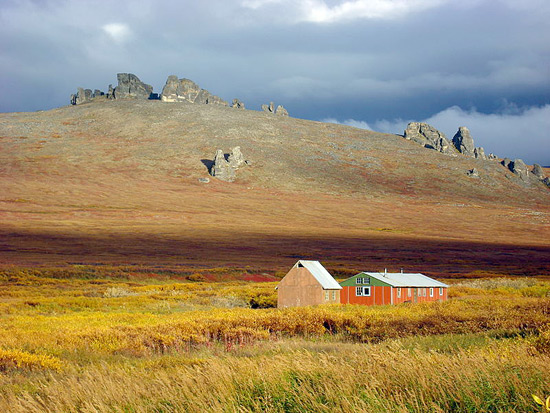
Seward Peninsula, 20,600 mi2 (53,400 km2)
Land-surface form
This area contains extensive uplands of broad convex hills and flat divides 500-2,000 ft (150-600 m) high, cut by sharp V-shaped valleys. Isolated groups of rugged glaciated mountains with peaks 2,500-4,700 ft (800-1,400 m) in elevation reach above coastal lowland and interior basins. The bedrock is chiefly metamorphic, with massive granitic intrusions. Periglacial processes predominate, and ice-wedge polygons are common.
Climate
The tundra climate is characterized by long, cold winters and short, cool summers. Nome has recorded a minimum temperature of -47F (-44C) and a maximum of 84F (29C). The average January temperature is about 3F (16C), and average temperatures in July are below 50F (10C). Average daily minimum temperatures in winter range from -11 to -2F (-24 to -19C), with an average daily maximum of 3 to 12F (-16 to -11C). Average daily minimum temperatures in summer range from 34 to 43F (1 to 6C), with an average maximum of 55 to 63F (13 to 17C). The growing season is less than 2 months. Fairly heavy snowfall occurs in winter, with even heavier concentrations of rain in summer. Average annual precipitation is about 18 in (460 mm); average annual snowfall ranges from 39 to 78 in (1,000 to 2,000 mm).
Vegetation
Vegetation exists in moist and wet tundra communities at lower elevations and alpine tundra communities in the high mountains. Vegetation is primarily composed of sedge tussocks interspersed with scattered willows and birches, with isolated spruce-hardwood forests.
Soil
The Inceptisol soils are generally poorly drained and shallow; the entire peninsula is underlain by permafrost. On hillslopes and ridges they are formed in very gravelly residual material over weathered bedrock. At lower elevations, soils are formed mainly in colluvial and alluvial sediments.
Fauna
Arctic foxes and Alaska hares are common here, and polar bears are often seen. Ribbon seals are characteristic of areas offshore. Reindeer were introduced at the turn of the century to provide an additional food source for people. Musk ox were introduced in 1970.
Spectacled eiders, ruddy turnstones, and black turnstones are common breeding birds in the lowland tundra of this province. The rare arctic loon, which breeds only in western Alaska, is characteristic of this region. The only known breeding grounds of the very rare bristle-thighed curlew extend throughout this region.
Data Source: United States Department of Agriculture, Forest Service
Province M126, part of the polar domain
Ahklun Mountains Tundra--Meadow
Ahklun Mountains, 16,700 mi2 (43,300 km2)
Land-surface form
Groups of rugged steep-walled mountains with sharp summits 2,000-5,000 ft (600-1,500 m) high, separated by broad flat valleys and lowlands, rise abruptly above the lowlands and low hills to the north and east. The mountains consist of strongly deformed sedimentary and volcanic rocks, with some bodies of schist. There are many narrow glacial lakes in U-shaped canyons. A few small cirque glaciers are found at the highest elevations.
Climate
The marine-phase tundra climate (described above for the Bering Tundra [Southern] Province) is characterized by cold winters and cool, short summers. Average daily temperatures range from a minimum of 3F (-16C) to a maximum of 18F (-8C). Mean summer temperatures have daily lows around 46F (8C) and highs around 61 to 66F (16 to 19C). Annual precipitation ranges from 39 in (1,000 mm) in the lowlands to over 78 in (2,000 mm) in the higher mountains, with a pronounced summer maximum. Average annual snowfall ranges from 78 to 196 in (2,000 to 5,000 mm), with a similar seasonal pattern.
Vegetation
Alpine tundra predominates in the mountains, whereas moist tundra communities occupy valley bottoms. Black spruce forest vegetation dominates some hills and ridges. Forests of white spruce, paper birch, and alder cover low hills along major rivers.
Soils
Principal soils are Inceptisols. Mountain soils are formed in very stony and gravelly colluvium material over bedrock. Valley soils are formed over glacial till. Permafrost occurs sporadically.
Fauna
Beaver are abundant mammals, with large numbers harvested annually.
Blackpoll warblers are common breeders in conifer stands in river valleys.
Wood frogs have been reported.
Sockeye salmon are the most abundant fish, but chum, king, and silver salmon are also numerous.
Data Source: United States Department of Agriculture, Forest Service
Province M127, part of the polar domain
Aleutian Oceanic Meadow--Heath
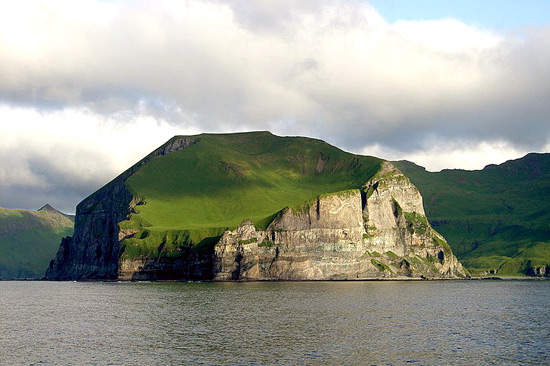
Aleutian Islands, Alaska Peninsula, West Kodiak Island 22,200 mi2 (57,500 km2)
Land-surface form
The islands that chiefly make up this province are mountainous, rising steeply from the sea. They contain more than 75 volcanoes, about half of which are know to have erupted during the last 200 years. Altitudes of the volcanoes decrease southwestward from 7,500 ft (2,300 m) at Mount Katmai on the Alaska Peninsula to 6,000 ft (1,800 m) on the Aleutian Islands. Not much of the land on the islands or on the peninsula is level. Steep slopes prevail all the way to water's edge, and shores are rocky and craggy. The Alaska Peninsula has intensely glaciated mountains indented with fjords that are bordered by cliffs. Several large lakes are on the peninsula.
Treeless slopes along the Pacific coast of the Alaska Peninsula, Aniakchak National Monument. Treeless slopes along the Pacific coast of the Alaska Peninsula, Aniakchak National Monument. (Photo: National Park Service.)
Climate
The climate is similar to that on the arctic coastal plain, except it is a marine phase (described above for the Bering Tundra [Southern] Province). Winters are less severe than those on the coastal plain, with temperature ranges of 18 to 27F (10 to 15C), as compared to a 54F (30C) range on the coastal plain. The climate is characterized by fog and rain, with the amount of precipitation varying little from month to month. Annual precipitation varies from 21 in (530 mm) to more than 78 in (2,000 mm). In general, smaller islands receive less precipitation than larger islands. Winds are often severe on the islands. Pacific Ocean water moving northward through the straits between the islands produces complex mixing with Bering Sea water, including upwelling. The Pribilof Islands in the Bering Sea are about at the southern limit of the arctic ice pack in winter.
Vegetation
Trees are absent from the Aleutian Province, although there are a few shrubs, chiefly dwarf willows. At lower elevations, there is a luxuriant growth of tall grasses, flowering plants, and ferns, with thickets of low willows in some places. A little higher up, several types of heath cover vast areas. The boreal forest and coastal rainforest are slowly encroaching from the east on the area of this province. This is explained by the assumption that the distribution of the vegetation is not yet adjusted to the climatic conditions produced by retreat of the last continental glaciers.
Soils
About 30 percent of the area consists of high mountains without soil cover. Dominant soils are Inceptisols formed from volcanic ash or pumice, with large components of pyroclastic materials. Permafrost is generally absent.
Fauna
The Aleutian Islands support no land mammals larger than foxes. Marine mammals such as seals, sea lions, and sea otters are abundant, using the islands for hauling out and as rookeries.
Bald eagles and hawks are prevalant predators, feeding on the millions of sea birds that use the islands and rocks as rookeries.
Data Source: United States Department of Agriculture, Forest Service
Province 131, part of the polar domain
Yukon Intermontane Plateaus Tayga
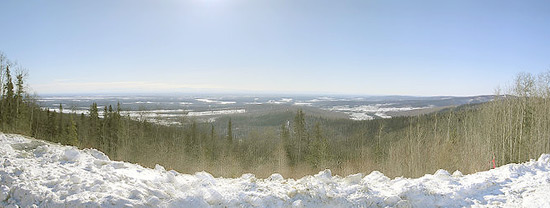
Interior Alaska, 56,100 mi2 (145,300 km2)
Land-surface form
A series of broad valleys, dissected uplands, and lowland basins covered with alluvial deposits extends across interior Alaska between the Brooks and Alaska Ranges. Four major rivers, the Yukon, Tanana, Koyukuk, and upper Kuskokwim, provide the area's outstanding hydrologic features. All four form wide valleys, with extensively braided channels; in some areas, the valleys contain hundreds of small lakes and marshes. Elevations are generally less than 2,000 ft (600 m).
Boreal forest of stunted black spruce Boreal forest of stunted black spruce in the Yukon Province, Kuskokwim River, Alaska.
Climate
The semiarid climate has extreme temperatures. Summers are short and hot, with temperatures up to 100F (38C); winters are long and severe, with temperatures as low as -75F (-60C). Average annual precipitation is only 17 in (430 mm). Temperature inversions, frequent in upland areas in winter, result in warmer temperatures on lower slopes than in bottom lands.
Vegetation
The major river bottoms support dense white spruce- cottonwood-poplar forests on floodplains and southfacing slopes up to about 1,000 ft (300 m). The undergrowth is dense shrubbery formed by green and thinleaf alder, willow, dogwood, and berries. The outer valley edges support evergreen and coniferous forests, often with pure stands of black spruce. The undergrowth consists of willow, dwarf birch, crowberry, fern, blueberry, lichens, and mosses. Upland areas are generally covered by a rather dense white spruce-birch-aspen-poplar forest. Pure stands of white spruce grow near streams. Typical undergrowth includes willow, alder, fern, berries, grasses, and mosses. Root systems are shallow. Water balance is likely the factor limiting growth in most of these areas because of the hot, dry summer climate. Old river terraces, ponds, and sloughs contain scattered but extensive bogs where the vegetation is chiefly sphagnum and other mosses, sedges, bog rosemary, and Labrador-tea. Marginal areas may support willow and alder.
Soils
River bottom and lower slope soils are generally deep, well-drained Inceptisols over sands, silts, and gravels that are only slightly weathered. Permafrost is discontinuous in major river valleys. Soils on northfacing slopes are shallow and poorly developed, with continuous permafrost. Upland soils that support spruce-hardwood forests are well-drained, shallow Inceptisols over continuous permafrost. Bog soils are Histosols.
Fauna
The spruce-hardwood forests provide excellent habitat for furbearers and other mammals. Brush zones and immature forests recovering from fires furnish especially good browse for moose. Common game animals in addition to moose include black and brown bear, wolf, wolverine, and caribou. Smaller mammals include lynx, red fox, beaver, mink, muskrat, weasel, river otter, marten, red and northern flying squirrel, and deer mouse.
Woodland game birds find plentiful habitat. Upland birds include northern hawk-owl, spruce grouse, and boreal chickadee.
Data Source: United States Department of Agriculture, Forest Service
Province 135, part of the polar domain
Coastal Trough Humid Tayga

Cook Inlet-Susitna lowland, Copper River lowland, 15,700 mi2 (40,700 km2)
Land-surface form
This province includes smooth and irregular plains surrounded by high mountains. Cook Inlet is level to rolling, with areas of ground moraine and stagnant ice topography, drumlin fields, eskers, and outwash plains. Most of the lowland is less than 500 ft (150 m) above sea level, with a local relief of 50-250 ft (15-80 m). The Copper River lowland is a broad basin of rolling to hilly moraines and nearly level alluvial plains on the site of a Pleistocene glacial lake. With an altitude of 1,000-2,000 ft (300-600 m), it is trenched by the Copper River and its tributaries, which form steep-walled canyons 100-500 ft (30-150 m) deep.
Climate
Although the climate is subarctic, it is less severe than the interior of Alaska, because the region is sheltered by the Alaska Range to the north. Proximity to the Gulf of Alaska makes the climate transitional to the marine climates to the south. Average annual temperatures range from 32 to 39F (0 to 4C), with a winter average of about 5F (-15C) and summer maximums of about 64F (18C). Average annual precipitation ranges from 10 to 18 in (260 to 460 mm). Annual snowfall averages from 4 to 10 in (100 to 260 mm).
Vegetation
Throughout the Cook Inlet lowlands, lowland spruce-hardwood forests are abundant. Bottom land spruce-poplar forest adjoins the larger river drainages, along with thickets of alder and willow. Wet tundra communities exist along the Cook Inlet coastline. The Copper River lowland is characterized by black spruce forest interspersed with large areas of brushy tundra. White spruce forests occur on southfacing gravelly moraines, and cottonwood-tall bush communities are common on large floodplains.
Soils
Spodosols are the principal upland soils in the Cook Inlet. Inceptisols are dominant in the Copper River lowland.
Fauna
The diversity of habitats in this province supports a large variety of species. Muskrats and red foxes abound, moose flourish in lowland areas, and Dall sheep are frequently seen in the uplands. Black bear populations are dense throughout the region.
Trumpeter swans nest here, and tundra swans are present during migration.
King, sockeye, and silver salmon are common or abundant.
Data Source: United States Department of Agriculture, Forest Service
Province 139, part of the polar domain
Upper Yukon Tayga
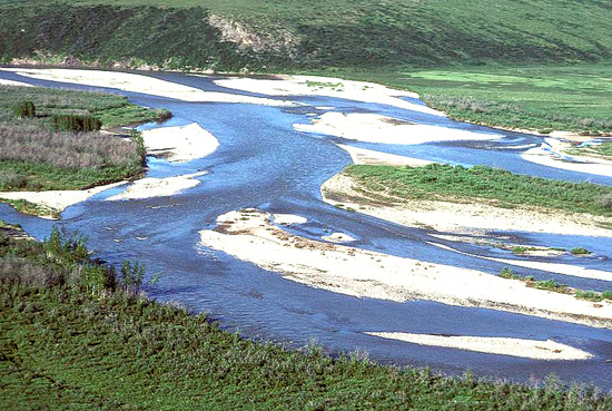
Yukon Flats, 13,000 mi2 (33,700 km2)
Land-surface form
This province is mostly a flat plain consisting of marshy lake-dotted flats rising from 300 ft (90 m) in altitude in the west to 600-900 ft (180-270 m) in the north and east. The province is made up of outwash fans and floodplains of the Chandalar, Christian, Sheenjek, and Upper Yukon Rivers. Rolling silt- and gravel-covered marginal terraces with sharp escarpments 150-600 ft (50-180 m) high rise above the flats, sloping gradually upward to altitudes of about 1,500 ft (460 m) at the base of surrounding uplands and mountains.
Climate
The climate is the extreme continental boreal type, with its large annual temperature range, severely cold winters, and short, hot summers. The average daily minimum temperature of the coldest month is -29F (-33C). At Fort Yukon, more than 130 days per year have a minimum temperature of 0F (-18C) or below. The record low at Fort Yukon is -78F (-61C), and the record high is 100F (38C). The growing season is less than 3 months. The region is semiarid, with an average annual precipitation of about 7 in (179 mm), with a summer maximum. Snowfall averages 45 in (1,150 mm) per year.
Vegetation
Bottom land spruce-aspen-birch grow on the better drained alluvial sites. Alder and willow form thickets on newly exposed alluvial sites subject to periodic flooding. The wettest sites have black spruce, willow, or graminoid marsh cover.
Soils
Principal soils are wet Inceptisols, mostly in flats and low areas. Lower parts of the floodplains are poorly drained and covered with peat, whereas river terraces are better drained.
Fauna
The fauna of the Yukon Flats Province are similar to those in other tayga regions. But this province provides what may be the most productive arctic habitat for avian wildlife on the continent. Predominant waterfowl species that breed in the region include the lesser scaup, pintail, scoter, and wigeon. The area supports 15-20 percent of remaining canvasbacks. Arctic, red-throated, and common loons, horned and red-necked grebes, and sandhill cranes are also common. Cliffs along the Yukon and Porcupine Rivers support several raptor species, including osprey, gyrfalcon, Swainson's hawk, and the endangered American peregrine falcon.
Data Source: United States Department of Agriculture, Forest Service
Province M131, part of the polar domain
Yukon Intermontane Plateaus Tayga--Meadow
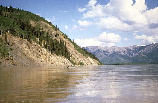
Nulato Hills, Kuskokwim Mountains, Nushagak-Big River Hills, 55,000 mi2 (142,400 km2)
Land-surface form
This area includes low mountains and hills interspersed with valleys. Elevations range from 980-1,970 ft (300-600 m) on ridges in the north to 4,920 ft (1,500 m) in the south. Much of the area exhibits glacial features, but in the north only the higher peaks were once covered by glaciers. Deep, narrow valleys are prevalent.
Climate
The climate is transitional from maritime to extreme continental. Winters are milder and summers cooler than in the interior. The average January temperature is about 4F (-16C), and the average July temperature is just above 50F (10C). The growing season is 4 months. Average annual precipitation is about 16 in (400 mm); precipitation is heaviest in late summer, when there are heavy rains. Snowfall ranges from 59 to 78 in (1,500 to 2,000 mm).
Vegetation
Black spruce forest vegetation is dominant in this area. Many hills and ridges, however, support only a tundra vegetation consisting of sedges and shrubs. There are forests of white spruce and paper birch on the hills overlooking the Yukon and Kuskokwim Rivers. Alpine meadow vegetation is predominant at higher elevations.
Soils
The dominant soils are Inceptisols.
Fauna
The fauna of the lowland forests are similar to those in surrounding tayga regions. There are low to moderate populations of brown bears. River otters are found throughout major river drainages. Northern bog lemmings populate wet alpine and subalpine meadows.
Alpine tundra provides habitat for horned larks, surfbirds, and white-tailed ptarmigan. Sharp-shinned hawks and golden eagles are common avian predators.
Data Source: United States Department of Agriculture, Forest Service
Province M135, part of the polar domain
Alaska Range Humid Tayga-Tundra-Meadow
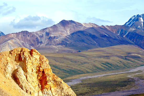
Alaska Range, Wrangell Mountains, 61,000 mi2 (158,000 km2)
Near timberline in Lake Clark National Park, Alaska Range.
Land-surface form
The Alaska Range is a continuation of the Pacific Coast Mountains extending in an arc across the northern Pacific. The towering, glaciated peaks of the Wrangell Mountains and of the Alaska Range--which includes Mt. McKinley at 20,320 ft (6,194 m)--typify the ruggedness of the area. The only major waterways are the Susitna and upper Copper Rivers.
Near timberline in Lake Clark National Park, Alaska Range. (Photo: National Park Service.)
Climate
The Alaska Range and the Wrangell Mountains have a transitional climate of severe winters and hot, dry summers. Temperatures range from 90F to -70F (32C to -57C). Precipitation averages only 16 in (410 mm) annually.
Vegetation
Vertical vegetational zonation characterizes the Alaska Range and Wrangell Mountains, beginning with dense bottom-land stands of white spruce and cottonwood on the floodplains and low terraces of the Copper and Susitna Rivers. Above the terraces, poorly drained areas up to 1,000 ft (300 m) support stands of black spruce. Upland spruce-hardwood forests of white spruce, birch, aspen, and poplar, with an undergrowth of moss, fern, grass, and berry, extend to timberline at about 2,500-3,500 ft (800-1,100 m). Tundra systems of low shrubs and herbaceous plants form discontinuous mats among the rocks and rubble above timberline. White mountain-avens may cover entire ridges in the Alaska Range, associated with moss campion, black oxytrope, arctic sandwort, lichens, grasses, and sedges. These tundra systems stop short of the permanent ice caps on the highest peaks.
Soils
Bottom-land and terrace soils of the Copper and Susitna Rivers are stratified, well-drained Entisols without pedogenic horizons. Upland hardwood forest soils are mostly shallow, well-drained Inceptisols. Permafrost is continuous on northfacing slopes, discontinuous on southfacing ones. Soils that support the moister tundra areas range from wet Inceptisols to Histosols. Alpine Inceptisols are generally shallow and poorly developed, with discontinuous or continuous permafrost.
Fauna
The Alaska Range supports large big-game populations of moose, Dall sheep, black and brown bear, wolf, caribou, and wolverine. Smaller mammals include beaver, red fox, lynx, otter, marten, squirrels, and weasel. Golden eagles, ptarmigan, ravens, and sharp-shinned hawks inhabit the uplands. Near timberline in Lake Clark National Park, Alaska Range. (Photo: National Park Service.)
Data Source: United States Department of Agriculture, Forest Service
Province M139, part of the polar domain
Upper Yukon Tayga--Meadow

Kokrine-Hodzana highlands, Yukon-Tanana upland, Porcupine Plateau, 68,400 mi2 (177,200 km2)
Land-surface form
This province is composed of rounded low mountains rising to 2,000-4,000 ft (600-1,200 m) in altitude, along with plateaus and highlands of rolling topography and gentle slopes interspersed with frequent valleys. They are underlain by a very complex geologic matrix of metamorphic, igneous, and sedimentary rocks. There are no glaciers. Isolated peaks, mostly near the Canadian border, rise to heights of 5,500-6,000 ft (1,700-1,800 m).
Low mountains along the Yukon River near Sam Creek. Low mountains along the Yukon River near Sam Creek. Vegetation is mostly brush and scrubby spruce, with some aspen and birch.
Climate
The area has an extreme continental boreal climate with a large annual temperature range, severely cold winters, and short, hot summers. Temperatures average from about 10 to 16F (-12 to -9C) in the north and 19 to 25F (-7 to -4C) at lower elevations in the south. Average annual precipitation ranges from 10 to 15 in (260 to 380 mm); precipitation is heaviest in late summer. Average snowfall ranges from 47 to 98 in (1,200 to 2,500 cm).
Vegetation
The vegetation pattern in the area is complex. Forests of white spruce, paper birch, and quaking aspen cover most lower slopes in the south and southfacing slopes in the north. Black spruce forest vegetation grows at higher elevations, on all northfacing slopes in the south, on all but steep southfacing slopes in the north, and on lower slopes with impeded soil drainage throughout the area. Above the black spruce forest, the vegetation is alpine meadow characterized by sedges on poorly drained sites and by low-growing shrubs on drier sites.
Soils
The dominant soils are Inceptisols. The entire area is underlain by discontinuous permafrost.
Fauna
Caribou and introduced bison inhabit the area, and Dall sheep are found in the high mountains. Upland furbearers, such as marten, mink, and shorttail and least weasels, are common. Hoary marmots populate mountainous areas, and woodchucks are found in the lower open woodlands. There is prime habitat for arctic ground squirrels and northern flying squirrels. The range of the longtail and yellow-cheeked voles in interior Alaska corresponds closely to this region.
The open mixed deciduous-conifer forests of the area support a large variety of birds. Common breeding birds include gray jays, boreal chickadees, northern flickers, red-tailed hawks, and boreal owls.
Data Source: United States Department of Agriculture, Forest Service
Province M244, part of the HUMID TEMPERATE DOMAIN
Pacific Coastal Mountains Forest--Meadow
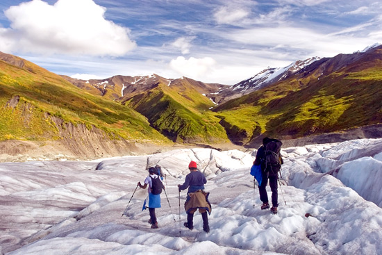
Coast Range of southeast Alaska, St. Elias Mountains, Chugach-Kenai Mountains, 40,000 mi2 (103,600 km2)
Land-Surface Form
The Coast Mountains rise precipitously from the sea to altitudes of about 9,000 ft (2,700 m), cut by an intricate network of deep, narrow fiords. Farther north, in the rugged St. Elias, Chugach, and Kenai Mountains, elevations range from sea level to more than 16,000 ft (4,900 m). Mount Logan (19,850 ft [6,050 m]) and Mount St. Elias (18,008 ft [5,490 m]) are the second and forth highest peaks on the continent of North America. Icefields and glaciers cover the higher parts of the mountains, forming some of the most extensive valley glacier systems in North America.
Snowfields above valley glaciers near Juneau, Tongass National Forest, Alaska. Snowfields above valley glaciers near Juneau, Tongass National Forest, Alaska.
Climate
The marine climate is the same as in Oregon and Washington, except that it has cool summers. Less than 4 months each year have average temperatures higher than 50F (10C). Despite the many glaciers, the climate is surprisingly mild, with average winter temperatures of about 32F (0C) and minimum temperatures of 0F (18C). Summer temperatures average in the 50's (10-15C), with highs in the 90's (32-37C). The growing season lasts 4 months or more. Precipitation is heavy, generally averaging more than 80 in (2,040 mm) annually, with some places getting more than 150 in (3,830 mm). Inland, the climate grows increasingly severe, partly because of rising distance from the ocean, but chiefly due to higher altitude. Topography and high precipitation form so much ice in the mountains that glaciers extend down to sea level despite mild temperatures. Above 3,000 ft (900 m), there is perennial ice, and above 8,000 ft (2,400 m), even summer storms are usually accompanied by snow.
Vegetation
The most important trees in the thick forest that covers the lower elevations of this province are Alaska-cedar, western hemlock, mountain hemlock, Sitka spruce, several species of willow, and black cottonwood. Several kinds of shrubs also grow in the forest, often forming a fringe on its margins. In many places, the dense vegetation is practically impenetrable.
The timberline is at low elevations, and much of the mountainous area above it is covered with nearly bare rocks, snowfields, and glaciers. Wherever soil has accumulated, however, there are grasses, herbs, and low shrubs. The timberline varies greatly in elevation from place to place, depending on slope exposure and other factors. Near Prince William Sound, for example, the timberline is usually between 1,000 and 2,000 ft (300 and 600 m), but sometimes it drops as low as 500 ft (150 m).
Soils
Icefields and bare rock or rubble make up about 70 percent of the area. The dominant soils are cool, moist Inceptisols.
Fauna
Due to the glacial character of the region, Sitka deer do not range into the area, nor do many of the large animals of the interior. The only important large mammals are brown and black bears and mountain goats. The principal small mammals are red squirrels, voles, and shrews.
Birds include some arctic types of water birds, such as murrelets and puffins. Land birds include sooty grouse, white-tailed ptarmigan, and Steller's jay.
There are no reptiles or amphibians.
Data Source: United States Department of Agriculture, Forest Service
Province M245, part of the HUMID TEMPERATE DOMAIN
Pacific Gulf Coastal Forest--Meadow
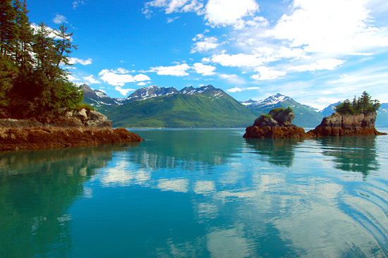
Southeast Alaska, Pacific Gulf Coast, eastern Kodiak Island, 23,900 mi2 (61,900 km2)
Land-surface form
The Alexander Archipelago, with its hundreds of islands formed by the partly submerged western foothills of the Coast Range, makes up most of this province. The larger islands have mountains 3,000-5,000 ft (900-1,500 m) high, with slopes covered by dense forest where they are not too steep. Long, narrow bays carved into the mountains by glaciers create extremely irregular coastlines. Northward, at Prince Willam Sound and Kodiak Island, the foothills are mixed with coastal lowlands consisting of alluvial fans, uplifted estuaries, morainal deposits, dunes, and river deltas and terraces.
Mountain slopes along the coast of the Pacific Gulf Coastal Province, Prince of Wales Island, Tongass National Forest, Alaska. Mountain slopes along the coast of the Pacific Gulf Coastal Province, Prince of Wales Island, Tongass National Forest, Alaska.
Climate
Though similar to that of the Pacific Coastal Mountains Province, the climate here is milder due to the region's generally lower elevation. At Sitka, Alaska, average monthly temperatures for January and August are approximately 28F and 50F (2C and 10C), respectively, for an annual temperature range of only 22F (8C). Precipitation, which averages 96 in (2,450 mm) per year, reaches a maximum in autumn.
Vegetation
A coastal rainforest of Sitka spruce and western hemlock provides the dominant vegetation. In poorly drained areas, a wetland vegetation of sphagnum moss, sedges, and willows fosters peatland development. Alder, cottonwood, and birch are found in low-lying areas and along major river channels.
Soils
The dominant soils are Spodosols.
Fauna
A characteristic large mammal is the Sitka black-tailed deer. Other mammals include the brown bear, black bear, wolf, red squirrel, and moose. The mountain goat is common on mainland mountain heights, but not on the islands. Sea otters and Steller's sea lions are common throughout Prince William Sound.
A conspicuous and characteristic bird is the Alaska bald eagle. A small sea bird, the marbled murrelet, nests in the tall trees of old-growth forests. Water birds are well represented, including loons and ducks, and there are many gulls and other shore birds. Common land birds include the red-breasted sapsucker, Pacific-slope flycatcher, and golden-crowned kinglet, and both the red and white-winged crossbills. The entire population of dusky Canada geese nests within this province.
Fish are abundant in the waters, including several species of salmon.
Data Source: United States Department of Agriculture, Forest Service
Province M411, Part of the HUMID TROPICAL DOMAIN
Puerto Rico

Puerto Rico, 3,700 mi2 (9,600 km2)
Land-Surface Form
Puerto Rico occupies a tropical oceanic position just south of the Tropic of Cancer (lat. 23 1/2N.). It is one of easternmost peaks of a partly submerged mountain range composed of folded Cretaceous and older rocks that have been cut by granitic intrusions. East-west trending ridges and peaks form the backbone of the island. Local relief is considerable, and slopes are steep. The highest peak in the Cordillera Central has an altitude of 4,389 ft (1,338 m). This terrain is flanked by marine limestone forming low plateaus with a karsts topography.
Climate
Puerto Rico has a tropical climate. The surrounding oceans and the persistent northeast trade winds maintain almost uniform climatic conditions throughout the year. But there is seasonality in precipitation, with a maximum occurring during the high-sun period, and precipitation varies greatly with altitude and exposure.
San Juan, on the north coast, has average temperatures ranging from about 75F (24C) in January to about 80F (27C) in July. Temperatures on the south coast average roughly 1F higher. For every rise in elevation of 1,000 ft (300 m), temperatures fall about 3 1/2F (2.2C). Frost is rare below 4,000 ft (1,200 m) and has never been recorded below 2,500 ft (800 m).
Precipitation is heaviest on the windward sides of the island; lee slopes are semiarid. The trade winds, blowing from just slightly north of east, first reach the Sierra de Luquillo, which has an average annual rainfall of more than 200 in (510 cm). Leeward of the Sierra de Luquillo is rain shadow. Rainfall is considerable in the Cordillera Central, especially in the west. Annual rainfall on the north coast, at San Juan, averages 61 in (1,560 mm); leeward of the Cordillera, rainfall is much less, averaging 35 in (890 mm) per year on the south coast, at Ponce. The island is in the hurricane belt. Hurricanes winds may exceed 100 mi/h (161 km/h) and be accompanied by torrential rain.
Vegetation
Most of Puerto Rico is under cultivation, but some rainforest remains on the wet north slopes of mountains such as the Sierra de Luquillo. Forest trees include mahogany, ebony, mamey, tree ferns, sierra palm, mango, Spanish cedar, sandalwood, and rosewood. They are associated with orchids, jungle vines, and matojo grass. Semiarid southern slopes support a dry forest association of acacia, royal palm, yucca, cacti, and dry grasses. Mangrove grows in swamps along much of the coast.
Soils
Much of the island is covered by thick residual soil containing about equal amounts of Oxisols, Ultisols, and Inceptisols.
Fauna
Puerto Rico has never had any large wild mammals. Native bats and lizards, along with the intentionally introduced mongoose and the unintentionally introduced rat, probably constitute nine-tenths of the island's vertrebrates vertebrates. The Agouti and armadillo are practically extinct.
The endangered Puerto Rican parrot occurs only here.
The boa, giant turtle, and several lizards are practically extinct. The coqui is a distinctive frog.
Offshore there is considerable coral and sport fishes abound in the coastal waters.
Data Source: United States Department of Agriculture, Forest Service
Province M423, Part of the HUMID TROPICAL DOMAIN
Hawaiian Islands
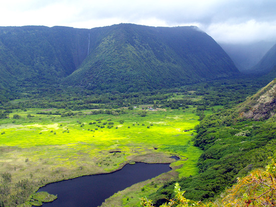
Hawaiian Islands, 6,500 mi2 (16,800 km2)
Land-Surface Form
The Hawaiian Islands occupy a tropical oceanic position just south of the Tropic of Cancer (lat. 23 1/2 N.). The five principal islands and four smaller ones are all volcanoes in various stages of erosion. The islands are hilly and mountainous, especially toward the east. About one-fourth of the area rises less than 650 ft (200 m) from sea level; one-half lies between 650 and 2,000 ft (200 and 600 m) in altitude, and another one-fourth reaches elevations of more than 2,000 ft (600 m). Hawaii, the largest and most easterly of the islands, has peaks higher than 13,000 ft (3,900 m), and some active volcanoes. Coastlines are mostly rocky and rough. Only Oahu and Niihau have much coastal plain. Surface streams are not abundant, because the ground is highly porous, composed as it is of lavas.
Dense rainforest in Hawaii Volcanoes National Park. Dense rainforest in Hawaii Volcanoes National Park. (Photo: National Park Service.)
Climate
Hawaii has a tropical climate. The surrounding ocean and highly persistent northeast trade winds maintain almost uniform climate throughout the year. At any given location, temperature and precipitation remain nearly constant year-round, but both vary greatly with altitude and exposure. Average temperatures at sea level range from about 70F (21C) in January to about 75F (24C) in July. Frost is rare below 4,000 ft (1,200 m) and has never been recorded below 2,500 ft (800 m). On the highest peaks, however, snow may fall in any month of the year. Precipitation is heaviest on the windward side of all the islands; lee slopes are semiarid. On Oahu, for example, the trade winds first reach the peaks on the northeast side of the island, and annual rainfall there averages more than 200 in (5,100 mm). Leeward is a rain shadow; annual rainfall at Honolulu averages about 20 in (510 mm).
Vegetation
Because the Hawaiian Islands are isolated, their flora are unique; many species were endemic before human settlement. Native plants form a variety of community types, including shrubland, forest, and areas of bog and moss-lichen.
Most shrubland lies in coastal lowlands on the lee sides of the mountains, extending to considerable altitudes where rainfall is slight.
Forests grow above the shrubland on the lee sides of mountains, extending to sea level on the windward sides. There are at least four kinds of native forest, reflecting differences in availability of moisture. One occurs on the dry lee sides of mountains up to about 2,500 ft (800 m). Wetter areas up to about 6,000 ft (1,800 m) support a forest that includes one of the principal lumber trees, the ohia; found with it are treelike ferns. A third type of forest grows above the ohia up to 9,500 ft (2,900 m) on Maui and Hawaii. A fourth is characterized by the koa tree, the largest tree on the islands, which reaches a height of 60 ft (18 m) and a diameter of 12 ft (3.7 m).
Shrubs mixed with scattered trees grow on the upper slopes of the high mountains, above the forest zone. Bogs are common in areas of heavy rainfall. Mosses and lichens grow above timberline, where rainfall is low and frost is frequent.
Soils
The islands have a complex pattern of leached Ultisols and Oxisols, Inceptisols, and rocky highlands and coastlines. Deep Ultisols are widespread on old lavas forming the older islands; young lavas on the younger islands are still rock.
Fauna
Because of their isolation, the Hawaiian Islands feature a meager but unique selection of fauna. Introduced mammals include the axis deer, Hawaiian wild boar, feral sheep, and goats.
There are large populations of such water birds as terns, tropicbirds, boobies, shearwaters, and petrels. The major islands have such special species as the white-tailed tropicbird, the rare Manx (Newell's) shearwater, and the dark-rumped petrel, all of which seek crater walls for nesting. Native land birds include hawks, owls, crows, warblers, and thrushes. Several species, including the crested honeycreeper and ou, are near extinction. Many species of birds have been introduced.
There are no native snakes and few other reptiles.
Data Source: United States Department of Agriculture, Forest Service
Copyright © 1993-2025 World Trade Press. All rights reserved.
